
Mission type Remote sensing COSPAR ID 2013-009A Launch mass 407 kilograms (897 lb) Inclination 98.54° | Operator ISROCNES SATCAT no. 39086 Launch date 25 February 2013 Inclination 98.54° | |
 | ||
Similar Megha‑Tropiques, Ocean Surface Topograp, Jason‑1, Near Earth Object Surveilla, Oceansat‑2 | ||
Satellite with argos and altika saral indo french scientific venture
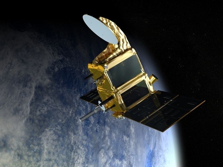
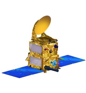
SARAL or Satellite with ARgos and ALtiKa is a cooperative altimetry technology mission of Indian Space Research Organisation (ISRO) and CNES (Space Agency of France). SARAL will perform altimetric measurements designed to study ocean circulation and sea surface elevation. The payloads of SARAL are The ISRO built satellite with payloads modules (ALTIKA altimeter), DORIS, Laser Retro-reflector Array (LRA) and ARGOS-3 (Advanced Research and Global Observation Satellite) data collection system provided by CNES was launched by Indian Polar Satellite Launch Vehicle rocket into the Sun-synchronous orbit (SSO). ISRO is responsible for the platform, launch, and operations of the spacecraft. A CNES/ISRO MOU (Memorandum of Understanding) on the SARAL mission was signed on Feb. 23, 2007.
Contents
- Satellite with argos and altika saral indo french scientific venture
- Lift off for indo french satellite saral
- Mission
- Ka band Altimeter ALTIKA
- ARGOS Data Collection System
- Solid State C band Transponder SCBT
- SARAL Applications
- References
SARAL was successfully launched on 25 February 2013, 12:31 UTC.
Lift off for indo french satellite saral
Mission
The SARAL mission is complementary to the Jason-2 mission of NASA/NOAA and CNES/EUMETSAT. It will fill the gap between Envisat and the Sentinel 3 mission of the European GMES program. The combination of two altimetry missions in orbit has a considerable impact on the reconstruction of sea surface height (SSH), reducing the mean mapping error by a factor of 4.
Ka band Altimeter, ALTIKA
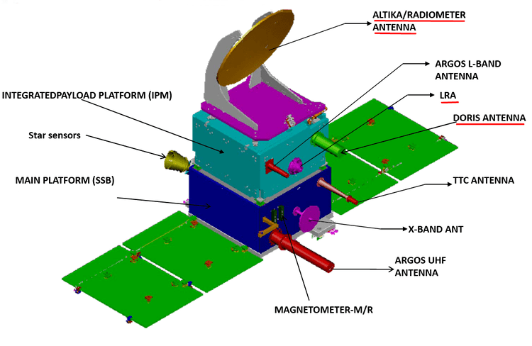
ALTIKA, the altimeter and prime payload of the SARAL mission, will be the first spaceborne altimeter to operate at Ka band. It built by the French National Space Agency CNES. The payload is intended for oceanographic applications, operates at 35.75 GHz. ALTIKA is set to take over ocean-monitoring from Envisat. It is the first to operate at such a high frequency, making it more compact and delivering better performance than the previous generation.
While existing satellite-borne altimeters determine sea level by bouncing a radar signal off the surface and measuring the return-trip time, ALTIKA operates at a high frequency in Ka band. The advantage of this is twofold. One, the earth’s atmosphere slows down the radar signal, so altimetry measurements are skewed and have to carry additional equipment to correct for this error. Since ALTIKA uses a different system, it does not have to carry an instrument to correct for atmospheric effects as current-generation altimeters do. ALTIKA gets around this problem by operating at a high frequency in Ka band. Another advantage of operating at higher frequencies is greater accuracy. ALTIKA will measure ocean surface topography with an accuracy of 8 mm, against 2.5 cm on average using current-generation altimeters, and with a spatial resolution of 2 km.
The disadvantage, however, is that high-frequency waves are extremely sensitive to rain, even drizzle. 10% of the data is expected to be lost. (Although this could be exploited to perform crude measurements of precipitation).
ARGOS Data Collection System
It built by the French National Space Agency CNES. ARGOS contributes to the development and operational implementation of the global ARGOS Data Collection System. It will collect a variety of data from ocean buoys to transmit the same to the ARGOS ground segment for subsequent processing and distribution.
Solid State C-band Transponder (SCBT)
Is from ISRO and intended for ground RADAR calibration. It is a continuation of such support provided by C-Band Transponders flown in the earlier IRS-P3 and IRS-P5 missions.
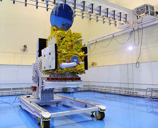
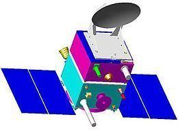
The payloads of SARAL are accommodated in the Indian Mini Satellite-2 bus, which is built by ISRO.
SARAL Applications
SARAL data products will be useful for operational as well as research user communities in many fields like