
Admin. region Oberpfalz Municipal assoc. Sünching Area 19.41 km² Local time Tuesday 3:56 PM Dialling code 09480 | District Regensburg Elevation 341 m (1,119 ft) Population 1,938 (31 Dec 2008) Postal code 93104 Administrative region Upper Palatinate | |
 | ||
Weather 13°C, Wind N at 13 km/h, 59% Humidity | ||
Sünching is a municipality in Germany. It is located in Bavaria, Oberpfalz (Upper Palatinate). It borders in the south to Niederbayern.
Contents
- Map of 93104 SC3BCnching Germany
- Geography
- Parts of Snchings community
- Politics
- History
- Sights
- Traffic
- Schools
- References
Map of 93104 S%C3%BCnching, Germany
Geography
Sünching has two rivers called Laber: the Große Laber (Big Laber) and the Kleine Laber (Little Laber); both flow to the Danube.
Parts of Sünchings community
(information as of August 28, 2002)
Ziegelstadel is official a part of Sünching.
Politics
The council has 12 members.
History
The aristocrats of the Sünchinger are demonstrable from the 12th century till the middle of 14th century. The counts of Seinsheim (a branch line of whom are the princes of Schwarzenberg) were owners from 1573 until 1916. The last count left it to his grandson, the baron Hoenning O'Carroll, who still resides in the castle with his wife and daughter.
Sights
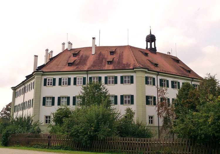
The palace of Sünching is an octagonal building, which is very rare in Europe. The house itself is painted green-white and has a big garden where often are weddings or confirmation parties. The court is used as a joiner's workshop.
In Sünching is mainly a Catholic church called Saint Johannes. As most of the people are Catholic, there's no Protestant church.
Traffic
Sünching has a railway station on the Regensburg–Passau line which is very important for the people in Sünching and near it.