
Demonym(s) Søndrelending Area 728 km² Local time Tuesday 2:33 PM | County Oppland Area rank 150 in Norway Time zone CET (UTC+1) Population 6,042 (2004) | |
 | ||
Weather 8°C, Wind S at 18 km/h, 56% Humidity | ||
Søndre Land is a municipality in Oppland county, Norway. It is part of the traditional region of Land. The administrative centre of the municipality is the village of Hov.
Contents
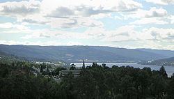
Map of S%C3%B8ndre Land, Norway
The old municipality of Land was divided into Søndre Land and Nordre Land in 1847. The area of Fluberg was separated from Søndre Land to become a separate municipality on 1 January 1914, but it was merged back into Søndre Land on 1 January 1962.
Name
The Old Norse form of the name was just Land which means "land". Therefore, the meaning of the name Søndre Land is "(the) southern (part of) Land". The parish and municipality of Land was divided in 1847.
Coat-of-arms
The coat-of-arms is from modern times. They were granted on 21 June 1985. The arms show three yellow tree trunks on a blue background. The blue colour of the shield symbolises the Randsfjorden, which borders the municipality. The tree trunks symbolise the importance of forestry and the sawmills in the municipality.
Geography
Søndre Land is bordered on the north by the municipality of Nordre Land, on the east by Gjøvik and Vestre Toten, on the west by Sør-Aurdal, and on the south by Gran in Oppland county. It is also bordered to the west by Ringerike in Buskerud county.
Søndre Land is 39.2 kilometres (24.4 mi) on a north-south axis and 31.3 kilometres (19.4 mi) east-west. It lies in the south of Oppland and on the northern end of Randsfjord. The highest elevation is Skjellinghovde with a height of 856 metres (2,808 ft). The main population centers include Holmen and Hov.