
Elevation 748 m (2,454 ft) Area 1,598 km² | Microregion Vão do Paranã Time zone BRT/BRST (UTC-3/-2) | |
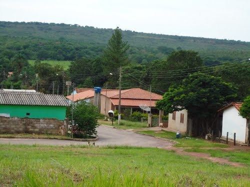 | ||
Sítio d'Abadia is a municipality in eastern Goiás state, Brazil.
Contents
- Map of SC3ADtio dAbadia State of GoiC3A1s Brazil
- Location
- Demographics
- Economy
- Health and education
- Tourism
- References
Map of S%C3%ADtio d'Abadia - State of Goi%C3%A1s, Brazil
Location
Sítio d'Abadia is located in a corner of eastern Goiás, 14 kilometers north of the border with Minas Gerais. It is about 30 kilometers west of the border with Bahia. It is one of the most isolated towns in the state of Goiás, and can be accessed only by paved highway by driving north to Damianópolis. It belongs to the Vão do Paranã statistical micro-region.
The distance to Goiânia is 561 km. Highway connections are made by BR-153 / Anápolis / GO-060 / Alexânia / Planaltina / Formosa / GO-020 / BR-030 / Vila Boa / Alvorada do Norte / GO-236 / Buritinópolis / Mambaí / GO-108 / Damianópolis.
Municipal boundaries are with:
Demographics
Economy
The economy is based on modest services, public administration, agriculture and cattle raising. There were no banks and 13 commercial establishments in August 2007. There were 52 automobiles in 2007. In 2006 there were 29,000 head of cattle. The main agricultural products were rice, bananas, sugarcane, manioc, beans, corn, and soybeans (2,000 hectares planted).
Agricultural data 2006
Health and education
Sítio d'Abadia is a very poor town in one of the poorest areas of the state. In 2000 it was ranked 235 out of 242 municipalities in the state of Goiás on the United Nations Human Development Index with a score of 0.643. Nationally it was ranked 3,875 out of 5,507 municipalities.
Tourism
Sítio d'Abadia has one of the largest waterfalls in the state located on the Rio Corrente. See Cachoeiras d'Abadia