
Demonym(s) aldeense Area 340 m² | Founded 16 May 1617 Postal Code 28.940-000 Local time Tuesday 4:28 AM | |
 | ||
Weather 21°C, Wind NW at 5 km/h, 91% Humidity Points of interest Southwest Beach, Museu da Aviação Naval, Praia da Pitória, Casa Dos Azulejos ‑ Centro C | ||
Mtb descida sapiatiba s o pedro da aldeia rj
São Pedro da Aldeia ([ˈsɐ̃w pedɾu ˈda awdeɪɐ]) is a municipality in Brazil. Its population was 88.013 (2010) and its area is 340 km².
Contents
- Mtb descida sapiatiba s o pedro da aldeia rj
- Map of SC3A3o Pedro da Aldeia State of Rio de Janeiro Brazil
- Geography
- Economy
- History
- References
Map of S%C3%A3o Pedro da Aldeia - State of Rio de Janeiro, Brazil
Geography
It lies in the east of Rio de Janeiro State on the Araruama Lake, 120 km from the state capital, Rio de Janeiro. The Araruama lagoon is the largest hypersaline lagoon in the world. Sports like windsurfing, kitesurfing and others like these are common because of the wind force in São Pedro da Aldeia
Economy
Salt extraction and fishing are the two most important industries.
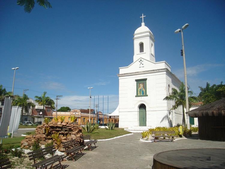
History
São Pedro da Aldeia was founded in 1660 by Catholic priests on the top of a hill named after Saint Peter, in honor of whom the city was named. A chapel was built that was later replaced by an architecturally significant church. Nowadays it is the main historical monument in the town and is protected by state laws. Some colonial buildings and landmarks remain today, such as the cemetery beside the church, where the family graves of the founders of the town remain. In the 1960s the Brazilian Air Force and Navy built a military airport there, bringing many migrants from others parts of the country and increasing the town's population.