
Elevation 77 m Number of airports 1 | Postal code 8220 Local time Tuesday 5:00 AM | |
 | ||
Weather 21°C, Wind NE at 11 km/h, 39% Humidity Civil parish | ||
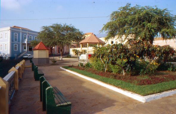
São Filipe (Portuguese for "Saint Philip", Cape Verdean Creole: San Filipi) is a town on the west coast of the island of Fogo, Cape Verde, it is possibly that it became a city today. It is the capital of the island, and the seat of the São Filipe Municipality. The island's airport, São Filipe Airport, is located on the southeastern edge of the town which offers flights to two mostly populated islands in the country and the island's port, 4 km north of the center at Vale de Cavaleiros serves with the islands of Fogo and Brava. The town's elevation is 20 meters and the area is slopey ranging up to 100 meters in the easternmost part. Two streams surround the town center.
Contents
- Map of Sao Filipe Cape Verde
- Subdivisions
- History
- Sights
- Churches
- Beaches
- Climate
- Festivities
- Other facilities
- Notable people
- Sports
- International relations
- References
Map of Sao Filipe, Cape Verde
Its main streets are Cobom, Biblioteca and Las Vegas.
Subdivisions
Its subdivisions of the built up portion of the city include:
History
São Filipe was founded in the 16th century and is considered to be the second oldest town in Cape Verde after Ribeira Grande, but a town charter was not granted before 1922. In 1655 São Filipe was destroyed by Flemish pirates.
Sights
Churches
Apart from Nossa Senhora da Conceição, the oldest Catholic church, there are a sightworthy chapel at Praça Alberto da Silva, a New Apostolic Church and two wards of the The Church of Jesus Christ of Latter-day Saints.
Beaches
Praia da Bila, a black beach, is 40 m below the city center. It is not very clean, and on many days the sea is very rough.
The inhabitants of the city prefer the beach at the harbour Porto de Vale de Cavaleiros, about 4 km in the north of Sao Filipe which is the island's westernmost point and one of few that it is an artificial section of land, others in Cape Verde are Ponta do Sol on Santo Antão. In spite of the harbour, the water is cleaner and the sea is not so rough. The most popular beach of the island is Ponta da Sallina in São Jorge.
Climate
Its climate is warmer than the higher parts of the island and the same as the lower parts of the country. It is a little humid than the upper areas. The average temperature is from 19 to 29 °C (66–84 °F), the highest is 29 °C in October and the lowest is 18.7 °C in February. Average rainfall is 272 millimeters, the highest is 121 mm in September and the lowest is without a single precipitation between the months of March and June.
Festivities
One of the municipal holidays is the Municipal Flag Day which is on May 1, same day as May Day.
Other facilities
The town has the island's main health center known as São Francisco de Assis. It also has a secondary education institute.
Notable people
Sports
The city has its stadiums – the Estadio 5 de Julho which is used for football (soccer) and a multisport complex named Simão Mendes used for basketball and volleyball games.
Académica do Fogo, Botafogo and Vulcânicos are the town's football clubs, they are also the island's most popular.
International relations
São Filipe is twinned with: