
Population 178 Civil parish Ryston Area 9.36 km² | OS grid reference TF629011 Sovereign state United Kingdom Local time Saturday 3:04 PM | |
 | ||
Weather 14°C, Wind NE at 21 km/h, 29% Humidity District | ||
Ryston is a small village and civil parish in the English county of Norfolk. It once had its own railway station.
Map of Ryston, UK
It covers an area of 9.36 km2 (3.61 sq mi) and had a population of 93 in 34 households at the 2001 census, the population increasing to 178 at the 2011 census. For the purposes of local government, it falls within the district of King's Lynn and West Norfolk.
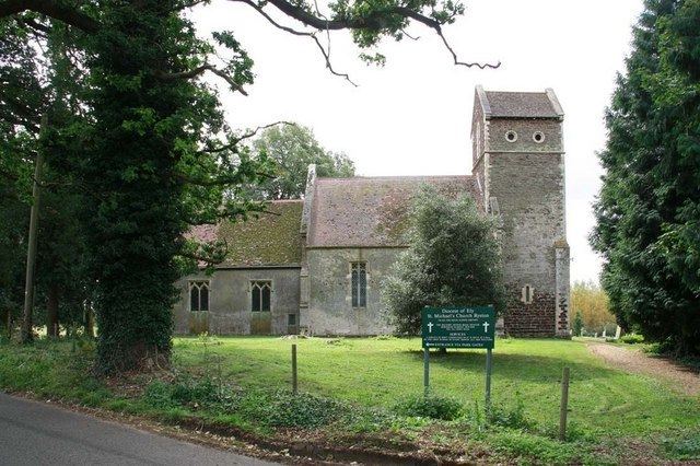
St Michael's parish church dates from the 12th century and was restored in 1901. It is a grade II* listed building.
Ryston Hall is a grade II* listed country house, built 1669-72 by the architect Sir Roger Pratt as his own home in 1669. It was later remodelled c.1780 by Sir John Soane and again by Anthony Salvin in 1867. The formal gardens and woodland walks are open to the public several times a year. The grounds also contain one of the oak trees that are called Kett's Oak, and is associated with Kett's Rebellion of 1549.