
Country United States Time zone Eastern (EST) (UTC-5) Elevation 383 m Local time Saturday 9:58 AM | State Vermont Chartered 1763 ZIP code 05042, 05069 Population 1,174 (2010) | |
 | ||
Weather -1°C, Wind N at 6 km/h, 85% Humidity Area 95.31 km² (94.53 km² Land / 78 ha Water) | ||
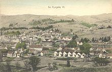
Ryegate is a town in Caledonia County, Vermont, United States. The population was 1,174 at the 2010 census. The town contains the villages of South Ryegate, East Ryegate, and Ryegate Corner.
Contents
Map of Ryegate, VT, USA
History
One of the New Hampshire Grants, it was chartered by Governor Benning Wentworth on September 8, 1763. Granted to Richard Jenness and 93 others, it was named Ryegate, a variant spelling of Reigate in Surrey, England. The first settlers were Aaron Hosmer and his family. Sold to John Witherspoon and others, the southern half of town was purchased in 1773 by two agents for the Scotch American Company of Farmers from Renfrew and Lanark, Scotland, whose members began settlement in 1774.
The town had excellent soil for the cultivation of grains, vegetables and orchards. Streams teemed with salmon and trout. Hills and valleys provided pasturage for grazing sheep and cattle. Connected in 1847 to the Connecticut & Passumpsic Rivers Railroad, the town by 1859 was noted for producing butter and leather. The Wells River supplied water power for one gristmill and five sawmills. In 1873, the Montpelier & Wells River Railroad was completed. In 1890, a big brickyard opened; then in 1906, the Ryegate Paper Company began operation. But the town's dominant industry was six granite quarries at Blue Mountain.
Geography
According to the United States Census Bureau, the town has a total area of 36.8 square miles (95.2 km2), of which 36.5 square miles (94.5 km2) is land and 0.31 square miles (0.8 km2), or 0.80%, is water. Bounded on the east by the Connecticut River (the boundary between Vermont and New Hampshire), Ryegate is drained by the Wells River. Blue Mountain, the highest point in the town, has an elevation of 2,192 feet (668 m) above sea level.
The town is crossed by Interstate 91, U.S. Route 5, and U.S. Route 302. It is bordered by the town of Newbury to the south, Groton to the west, and Barnet to the north. To the east, across the Connecticut River lies Bath, New Hampshire.
Demographics
As of the census of 2000, there were 1,150 people, 435 households, and 324 families residing in the town. The population density was 31.4 people per square mile (12.1/km2). There were 564 housing units at an average density of 15.4 per square mile (6.0/km2). The racial makeup of the town was 98.35% White, 0.09% African American, 0.43% Native American, 0.35% Asian, and 0.78% from two or more races. Hispanic or Latino of any race were 0.17% of the population.
There were 435 households out of which 31.3% had children under the age of 18 living with them, 61.8% were married couples living together, 7.4% had a female householder with no husband present, and 25.3% were non-families. 19.8% of all households were made up of individuals and 7.8% had someone living alone who was 65 years of age or older. The average household size was 2.64 and the average family size was 3.05.
In the town, the population was spread out with 25.2% under the age of 18, 7.0% from 18 to 24, 24.6% from 25 to 44, 28.4% from 45 to 64, and 14.7% who were 65 years of age or older. The median age was 41 years. For every 100 females there were 107.2 males. For every 100 females age 18 and over, there were 100.0 males.
The median income for a household in the town was $36,761, and the median income for a family was $41,607. Males had a median income of $26,875 versus $21,705 for females. The per capita income for the town was $17,880. About 3.3% of families and 5.9% of the population were below the poverty line, including 6.2% of those under age 18 and 5.2% of those age 65 or over.