
- summer (DST) CEST (UTC+2) Area 34.95 km² | Elevation 320 m Local time Saturday 2:06 PM | |
 | ||
Weather 11°C, Wind W at 16 km/h, 45% Humidity Points of interest Schloss Rychnov nad Kněž, Muzeum a galerie Orlických, Muzeum a galerie Orlických, Zámek Kolowrat, Zvonice Kryštof | ||
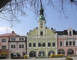
Rychnov nad Kněžnou ( [ˈrɪxnof ˈnat kɲɛʒnou̯]; German: Reichenau an der Knieschna) is a town in the Hradec Králové Region of the Czech Republic. It has around 12,000 inhabitants.
Contents
Map of Rychnov nad Kn%C4%9B%C5%BEnou, Czechia
This is a small town, with a sprinkling of other small towns in the vicinity. The nearest big city (more than 100,000 inhabitants) is Hradec Králové which is about 32 km to the west.
History
The town was founded during the colonization of the Orlické Mountains, when Heřman z Drnholce obtained a strip of land around Rychnov from Ottokar II of Bohemia. The first known written note about Rychnov is attributed to Heřman z Drnholce, in a document dated from the 1st of February 1258 in Vienna.
Rychnov was located at an important trading route.
Until 1918, the town was part of the Austrian monarchy, and head of the REICHENAU district, one of the 94 Bezirkshauptmannschaften in Bohemia. The 1878 cancellation under Franz-Joseph I ruling is an early use of German and Czechoslovakian languages.
Twin towns — Sister cities
Rychnov nad Kněžnou is twinned with: