
Primary inflows Surface area 4,580 km (1,770 sq mi) Max. depth 28 m (92 ft) Surface elevation 102 m | Basin countries Russia Average depth 5.6 m (18 ft) Area 4,580 km² Mean depth 5.6 m | |
 | ||
Type Hydroelectric reservoir Inflow source Volga River, Mologa River, Sheksna River | ||
Rybinsk Reservoir (Russian: Ры́бинское водохрани́лище, Rybinskoye vodokhranilishche; [ˈrɨbʲɪnskəɪ vədəxrɐˈnʲilʲɪɕːɪ]), informally called the Rybinsk Sea, is a water reservoir on the Volga River and its tributaries Sheksna and Mologa, formed by Rybinsk Hydroelectric Station dam, located in the Tver, Vologda, and Yaroslavl Oblasts. At the time of its construction, it was the largest man-made body of water on Earth. It is the northernmost point of the Volga. The Volga-Baltic Waterway starts from there. The principal ports are Cherepovets in Vologda Oblast and Vesyegonsk in Tver Oblast.
Map of Rybinsk Reservoir, Russia
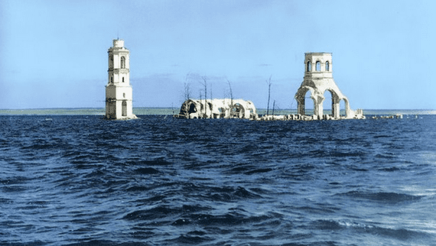
The construction of the dam in Rybinsk started in 1935. The filling of the reservoir started on April 14, 1941, and continued until 1947. Some 150,000 people had to be resettled elsewhere, and the historic town of Mologa in Yaroslavl Oblast along with 663 villages have completely disappeared under water. In recent years however, it has been increasingly viewed as a typical example of Stalinism for its disregard of the interests of the local people affected by the project. Today the dam is less important for hydroelectric power supply (output is 346 MW) than it used to be, and the ecological damage caused by the reservoir is being reassessed.