
OS grid reference SO870410 Country England Post town WORCESTER Shire county Worcestershire Civil parish Ripple, Worcestershire | Region West Midlands Sovereign state United Kingdom Postcode district WR8 District Malvern Hills District | |
 | ||
Weather 12°C, Wind NE at 18 km/h, 59% Humidity | ||
Ryall is a village in the south of Worcestershire, England, on the east bank of the River Severn, near Upton-upon-Severn on the opposite bank.
The village is located on the A38 road that runs roughly parallel to the River Severn, on its Tewkesbury to Kempsey stretch, and on the A4104, which crosses the Severn at Upton.
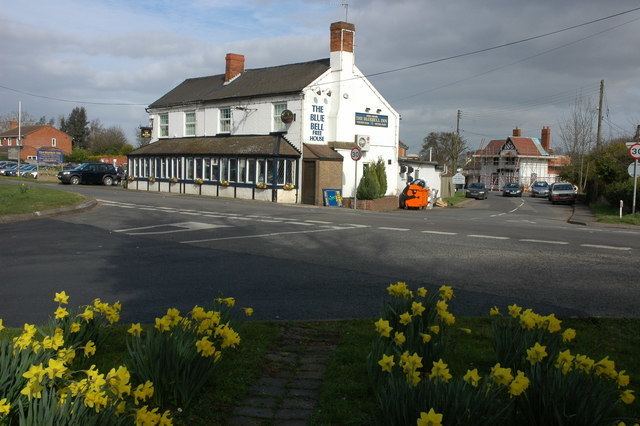
The part of the village by the A38 is called The Grove, and includes the Blue Bell public house. The part along the A4104 is called Holly Green.
References
Ryall, Worcestershire Wikipedia(Text) CC BY-SA