
Country United States of America | ||
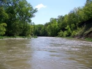 | ||
The Rush River, in the U.S. state of Minnesota, is a 19.8-mile-long (31.9 km) waterway located entirely in Sibley County, although its watershed also includes parts of Nicollet and McLeod counties. It is a tributary of the Minnesota River.
Contents
- Map of Rush River Minnesota USA
- North Branch Rush RiverEdit
- Middle Branch Rush RiverEdit
- South Branch Rush RiverEdit
- References
Map of Rush River, Minnesota, USA
The Rush River begins at the junction of its Middle and North Branches, at approximately 94.1W longitude, and 44.5N latitude. It then flows generally to the east, with the South Branch joining it at approximately 94.0W and 44.5N. It continues east until it joins the Minnesota River 2.5 miles (4.0 km) north-northeast of Le Sueur, Minnesota, which then proceeds generally north and east until it joins the Mississippi River.
North Branch Rush RiverEdit
The North Branch Rush River drains from Titlow Lake east of Gaylord, Minnesota, and flows 11.3 miles (18.2 km) southeast, joining the Middle Branch Rush River to form the Rush River.
Middle Branch Rush RiverEdit
The Middle Branch Rush River starts northwest of Gibbon, Minnesota and flows 36.0 miles (57.9 km) east until it joins the North Branch and forms the Rush River.
South Branch Rush RiverEdit
The South Branch Rush River starts between Winthrop and Lafayette, 10 miles (16 km) west-southwest of Gaylord near the Sibley-Nicollet county line, and flows 34.1 miles (54.9 km) east until it joins the Rush River.