
 | ||
vol 3 rupes nigra eng sub
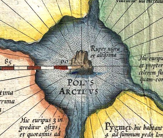
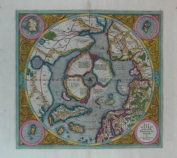
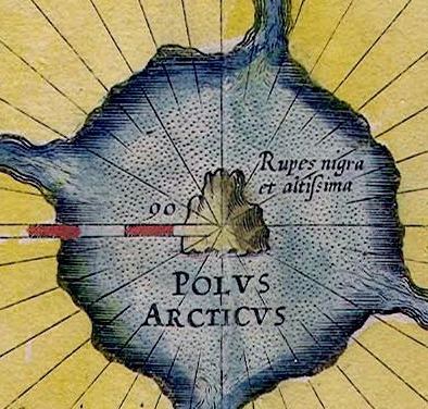
The Rupes Nigra ("Black Rock"), a phantom island, was believed to be a 33-mile-wide black rock located at the Magnetic North Pole or at the North Pole itself. It purportedly explained why all compasses point to this location. The idea came from a lost work titled Inventio Fortunata, and the island features on maps from the sixteenth and seventeenth centuries, including those of Gerardus Mercator and his successors. Mercator describes the island in a 1577 letter to John Dee:
Contents
- vol 3 rupes nigra eng sub
- La misteriosa isla magn tica rupes nigra verdadero misterio
- In fiction
- References
La misteriosa isla magn tica rupes nigra verdadero misterio
In fiction
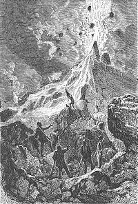
In Jules Verne's novel "The Adventures of Captain Hatteras" (1866), the North Pole features Queen Island, a landmass formed by the volcanic Mount Hatteras, situated within an Open Polar Sea.
References
Rupes Nigra Wikipedia(Text) CC BY-SA