
Population 549 (2011 census) Postcode(s) 3388 Founded 1873 Local time Saturday 8:12 AM | Established 1873 Elevation 67 m Postal code 3388 | |
 | ||
Location 290 km (180 mi) NW of Melbourne49 km (30 mi) E of Horsham, Victoria18 km (11 mi) E of Murtoa Weather 19°C, Wind NE at 13 km/h, 76% Humidity | ||
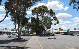
Rupanyup (/rəˈpænjəp/ rə-PAN-yəp) is a small town in rural Victoria, Australia. As of the 2011 census, it had a population of 549. The name Rupanyup is an Aboriginal word meaning 'branch hanging over water'.
Map of Rupanyup VIC 3388, Australia
The Post Office opened on 22 February 1875 as Karkarooc and was renamed Rupanyup in 1876.
The town has an Australian rules football team competing in the Horsham & District Football League.
Golfers play at the course of the Rupanyup Golf Club on Frayne Avenue.
References
Rupanyup Wikipedia(Text) CC BY-SA