
 | ||
Runnymede Road is a street in the west end of Toronto, Canada. It runs from Morningside Avenue at its south end (west of High Park) and ends at Henrietta Street, north of St. Clair Ave.
Map of Runnymede Rd, Runnymede QLD 4615, Australia
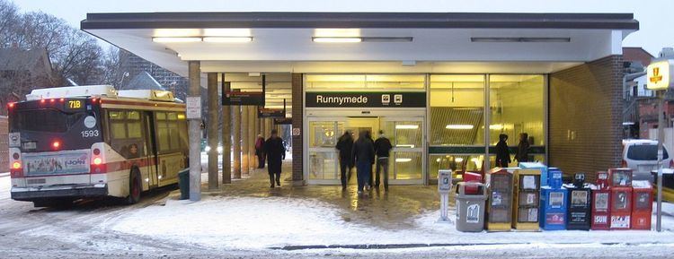
John Scarlett, a mill and distillery owner along the Humber River, laid out what is now Runnymede Road in 1817. There is also a subway station on the Bloor–Danforth line by this street.
Despite its name, Runnymede Collegiate Institute is actually on Jane Street, although it is located in the Runnymede neighbourhood. Runnymede Park is located one block east of Runnymede Road, north of its intersection with the Canadian Pacific Railway line.
The Toronto Civic Railways Bloor West streetcar route was not extended to Runnymede until 1917, because a large ravine near present-day Glenderman Avenue.
The 71 Runnymede, 77 Swansea, and 79 Scarlett Road bus routes run along this street and links with Runnymede Station.
According to Tony Ruprecht's history of Toronto's ethnic communities, Toronto's Many Faces, Dundas Street between Runnymede and Keele is the heart of the Maltese diaspora.
HMCS Runnymede, a World War II Royal Canadian Navy vessel, was named after the Runnymede neighbourhood.