
c. 1365–1867 → Disestablished 1867 | Established c. 1365 1844 2,700,000 | |
 | ||
1844 124,630 km (48,120 sq mi) | ||
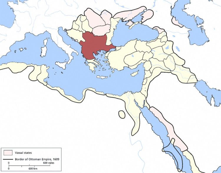
The Eyalet of Rumeli or Rumelia (Ottoman Turkish: ایالت روم ایلی; Eyālet-i Rūm-ėli), also known as the Beylerbeylik of Rumeli, was a first-level province (beylerbeylik or eyalet) of the Ottoman Empire encompassing most of the Balkans ("Rumelia"). For most of its history it was also the largest and most important province of the Empire.
Contents
- Rumelia eyalet
- History
- Governors
- 1475
- 1520s
- 1644
- 17001730
- Early 19th century
- Mid 19th century
- Wholly or partly annexed to the Eyalet
- Created from the Eyalet
- References
The capital was in Adrianople (Edirne), Sofia, and finally Monastir (Bitola). Its reported area in the 19th century was 48,119 square miles (124,630 km2).
Rumelia eyalet
History
The first beylerbey of Rumelia was Lala Shahin Pasha, who was awarded the title by Sultan Murad I as a reward for his capture of Adrianople (modern Edirne) in the 1360s, and given military authority over the Ottoman territories in Europe, which he governed effectively as the Sultan's deputy while the Sultan returned to Anatolia.
From its foundation, the province of Rumelia—initially termed beylerbeylik or generically vilayet ("province"), only after 1591 was the term eyalet used—encompassed the entirety of the Ottoman Empire's European possessions, including the trans-Danubian conquests like Akkerman, until the creation of further eyalets in the 16th century, beginning with the Archipelago (1533), Budin (1541) and Bosnia (1580).
The first capital of Rumelia was probably Edirne (Adrianople), which was also, until the Fall of Constantinople in 1453, the Ottomans' capital city. It was followed by Sofia for a while and again by Edirne until 1520, when Sofia became the definite seat of the beylerbey. At the time, the beylerbey of Rumelia was the commander of the most important military force in the state in the form of the timariot sipahi cavalry, and his presence in the capital during this period made him a regular member of the Imperial Council (divan). For the same reason, powerful Grand Viziers like Mahmud Pasha Angelovic or Pargalı Ibrahim Pasha held the beylerbeylik in tandem with the grand vizierate.
In the 18th century, Monastir emerged as an alternate residence of the governor, and in 1836, it officially became the capital of the eyalet. At about the same time, the Tanzimat reforms, aimed at modernizing the Empire, split off the new eyalets of Üsküb, Yanya and Selanik and reduced the Rumelia Eyalet to a few provinces around Monastir. The rump eyalet survived until 1867, when, as part of the transition to the more uniform vilayet system, it became part of the Salonica Vilayet.
Governors
1475
A list dated to 1475 lists seventeen subordinate sanjakbeys, who controlled sub-provinces or sanjaks, which also functioned as military commands:
1520s
Another list, dating to the early reign of Suleiman the Magnificent (r. 1520–1566), lists the sanjakbeys of that period, in approximate order of importance.:
The Çingene, Müselleman-i Kirk Kilise and Voynuks were not territorial circumscriptions, but rather represented merely a sanjakbey appointed to control these scattered and often nomadic groups, and who acted as the commander of the military forces recruited among them. The Pasha-sanjak in this period comprised a wide area in western Macedonia, including the towns of Üskub (Skopje), Pirlipe (Prilep), Manastir (Bitola) and Kesriye (Kastoria).
A similar list compiled c. 1534 gives the same sanjaks, except for the absence of Sofia, Florina and Inebahti (among the provinces transferred to the new Archipelago Eyalet in 1533), and the addition of Selanik (Salonica).
1644
Further sanjaks were removed with the progressive creation of new eyalets, and an official register c. 1644 records only fifteen sanjaks for the Rumelia Eyalet:
1700/1730
The administrative division of the beylerbeylik of Rumelia between 1700-1730 was as follows:
Early 19th century
Sanjaks in the early 19th century:
Mid-19th century
According to the state yearbook (salname) of the year 1847, the reduced Rumelia Eyalet, centred at Manastir, encompassed also the sanjaks of Iskenderiyye (Scutari), Ohri (Ohrid) and Kesrye (Kastoria). In 1855, according to the French traveller A. Viquesnel, it comprised the sanjaks of Iskenderiyye, with 7 kazas or sub-provinces, Ohri with 8 kazas, Kesrye with 8 kazas and the pasha-sanjak of Manastir with 11 kazas.