Girish Mahajan (Editor)

Rufisque Department

Updated on
Edit
Like
Comment
Share on FacebookTweet on TwitterShare on LinkedInShare on Reddit
Country
  
Senegal

Capital
  
Rufisque

Area
  
372 km²

Region
  
Dakar Region

Time zone
  
GMT (UTC+0)

Local time
  
Friday 10:24 AM

Rufisque Department

Weather
  
25°C, Wind N at 24 km/h, 55% Humidity

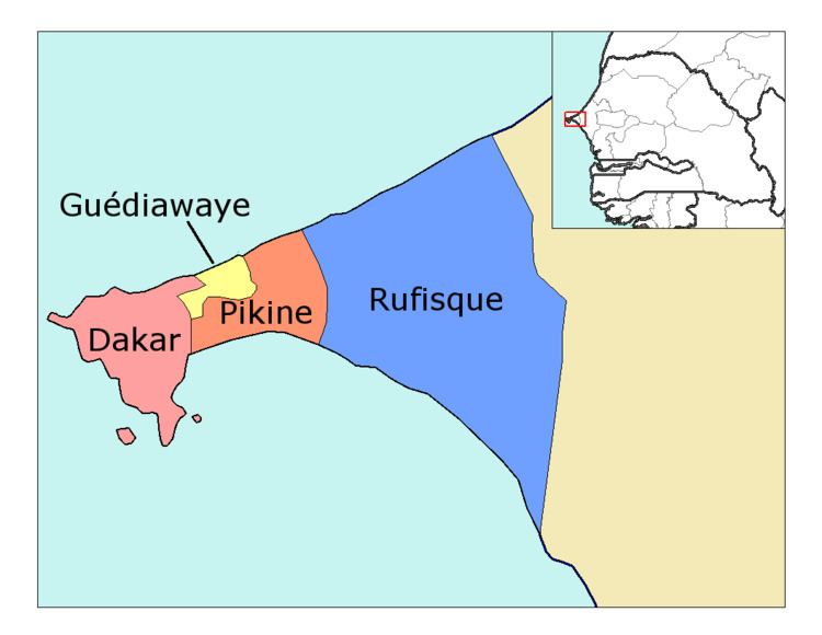
Rufisque Department is one of the 45 departments of Senegal and one of the four which make up the Dakar Region.

Contents

Map of Rufisque, Senegal

There are six urban communes within the department: Bargny, Sébikotane, Diamniadio, Jaxaay-Parcelle-Niakoul Rap, Sangalkam and Sendou. The rest of the department is divided into two arrondissements.

  • Rufisque Arrondissement is subdivided into three communes de arrondissement, Rufisque Est, Rufisque Nord and Rufisque Ouest.
  • Bambylor Arrondissement is subdivided into 3 rural districts (communautés rurales);
  • Yéne
  • Bambylor
  • Tivaouane Peulh-Niaga
  • Historic sites

  • The historic centre or Old Rufisque, lying between the East Canal, the West Canal, the railway line and the seafront.
  • National printworks
  • Former William Ponty school at Sébikotane
  • Ancient dunes at Kounoune, Neolithic site
  • Lake Retba, The Rose Lake or Pink Lake (coloured pink by algae)
  • References

    Rufisque Department Wikipedia