
Country India PIN 321402 Area 11,118 km² Local time Friday 12:08 PM Area code 915645 | State Rajasthan Time zone IST (UTC+5:30) Telephone code 915645 Elevation 431 m Population 12,034 (2011) | |
 | ||
Weather 34°C, Wind N at 10 km/h, 29% Humidity | ||
Rudawal (रूदावल) is a town in Bharatpur district, Rajasthan, India.
Contents
Map of Rudawal, Rajasthan 321402
History
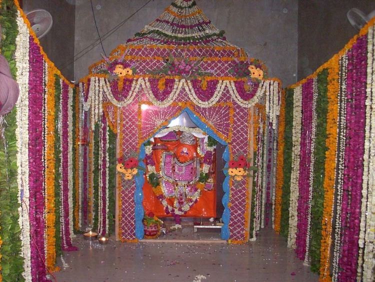
The history of Rudawal is very Interesting. The town was estimated or it was founded on 1700. The Palace quarter encloses a sprawling Lack, (Bandh Baretha), formal gardens, and a small lake. crowns the hill in the northwest corner of the town. The Hanumaan Ji Temple is one of the India's Heritage Sites.[2] Included on the Golden Triangle tourist circuit, along with Delhi and Agra, Gwaliwar Rudawal is an extremely popular tourist destination in Rajasthan and India.
In ancient time BHARATPUR region came under the MUGHAL Kingdom.
Modern Rudawal was founded in 1808 by Maharaja ROOP SINGH of Rupwas. Initially, his Tahsil was Tahsil, which lies 17 km from Rudawal. The senior citizen is says that At 1527 the time of the Battle of Khanwa Tofkhane Mughals were made. The soil is still out in their remains.
Philosophical point
Rudawal is a centre for both traditional and modern industries. It is famous as a large exporter of sandstone, stone in Asia and is the only Town finishing sandstone, or JALI AND PILLER, in the world.
Art & Culture
in an area of art & Culture Rudwal is very ahead. It is had a different impression in art. It is known for the pink stone carving.