
Country New Zealand Ward Waiapu Ward Highest elevation 75 m (246 ft) Asian population 2.2% Local time Friday 3:03 PM Area code 06 | Region Gisborne Region Electorate East Coast Lowest elevation 25 m (82 ft) Population 750 (2013) Mayor Meng Foon | |
 | ||
Weather 22°C, Wind N at 23 km/h, 81% Humidity Neighborhoods Whareponga, Tuparoa, Pakihiroa, Port Awanui | ||
Ruatoria, also written as Ruatōria, is a town in the Waiapu Valley of the Gisborne Region in the northeastern corner of New Zealand's North Island. The town was originally known as Cross Roads, and was named Ruatōrea in 1913, from the Māori Rua-a-Tōrea (the storage pit of Tōrea). In 1925 the name was altered to the current spelling, although some texts retain the original spelling.
Contents
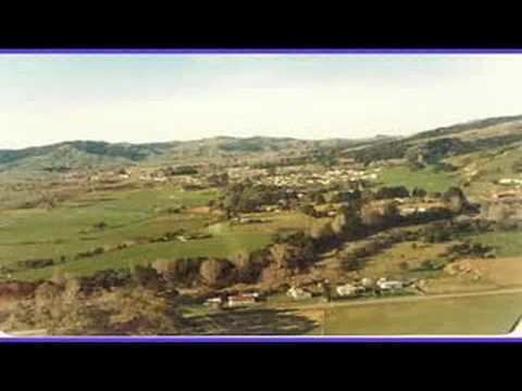
- Map of Ruatoria New Zealand
- Geography
- Climate
- Industry
- History
- Significance to Mori
- Notable residents
- Other
- References
Map of Ruatoria, New Zealand
As of the 2013 census, it was the third largest centre of population in the sparsely populated region, yet had a population of only 750 (18 less than the region's second largest town, Tolaga Bay). This was a decrease of less than 1% (6 people) since the 2006 census. It is the centre of population and largest town in the Waiapu Valley. 94.8% of the population is Māori, and 46% of the population is able to speak te reo Māori — both significantly higher than regional or national averages.
Geography
As the crow flies, Ruatoria is approximately 90 km (56 mi) north-northeast of Gisborne, and 30 km (19 mi) southwest of the East Cape Lighthouse. By road it is 128 km (80 mi) from Gisborne, 3 km (1.9 mi) off State Highway 35. It is at the bottom of the Waiapu Valley on the banks of the Waiapu River just downstream of where the river is formed by the joining of the Mata and Tapuaeroa Rivers.
Climate
Precipitation is prodigiously high — the annual average precipitation total approaches 2,000 mm (79 in). Precipitation is heavy all year-round, yet is particularly prodigious in the austral winter months from May to September. On 7 February 1973, Ruatoria had the highest ever air temperature recorded in the North Island (39.2 °C or 102.6 °F), the same day the nation's highest temperature was recorded in the South Island town of Rangiora (42.4 °C or 108.3 °F).
Industry
The principal industries in the district are related to agriculture and forestry. Attempts to sink oil wells in the area in the 1920s proved unprofitable.
History
The original shop, bunk house and cook house in the township of Tuparoa were destroyed by fire on two occasions between 1907 and 1913. Commerce was moved inland 5 miles to the area known as The Crossroads, northeast of the present town sitting on the area of the first river plain where it drops to the present river plain where the roads went north-south and to the east. (There was a race course on land alongside the Waiapu River below The Crossroads but that was abandoned by the end of the second world war). The Crossroads too was destroyed by fire during the first world war and in 1920 the first general store and accommodation was erected by William Hayes Owen Johnston (1890-1960) on what is now Tuparoa Road. (The shop has been dismantled after his death in 1960) He is buried with his third wife in the cemetery at Mahora on the Tuparoa road just before the junction with the side road to Reparoa. (His first and second wives were of the Gerrard family of Tuparoa and are buried in the cemetery at the top of the hill on the northern side of the creek which separated the old Tuparoa settlement).
From about 1925 onwards, Ruatoria began to replace Tuparoa as the main urban centre of the East Coast district of New Zealand. The transition to Ruatoria from Tuparoa was brought about by the increased reliability of State Highway 35, which at that time ran via the main street of Ruatoria. Tuparoa was disadvantaged by unreliable road access and a lack of all weather harbour.
In the 1980s, Ruatoria was briefly notorious for an outbreak of arson attacks in the town, during a period of severe economic downturn.
Significance to Māori
The Ngāti Porou proverb of identity relates to the area — Ko Hikurangi te maunga, ko Waiapu te awa, ko Ngāti Porou te iwi (Hikurangi is the mountain, Waiapu is the river, Ngāti Porou is the tribe). Ruatoria is within the iwi's rohe, and Te Runanganui o Ngāti Porou has offices located in the town.
The Waiapu River is of immense cultural, spiritual, economic, and traditional value to local Māori. According to traditional beliefs, a number of taniwha dwell in and protect the river, in turn protecting the valley and its hapū. Taniwha believed to be in Waiapu River include Kotuwainuku, Kotuwairangi, Ohinewaiapu, and Ngungurutehorowhatu.
According to an affidavit of Hapukuniha Te Huakore Karaka, two taniwha were placed in strategic locations in the river to protect the hapū from invading tribes — one near Paoaruku (a locality at 37°49′38″S 178°20′21″E), and one at the Wairoa River (a small creek at 37°50′13″S 178°24′00″E). Karaka said that a bridge was built from Tikitiki to Waiomatatini, to the protest of local Māori who were concerned that it would disturb the taniwha. The night before the bridge was completed, a storm came washing the bridge away — the weather till then had been calm. From then, one person would drown in the river nearly every year. If it did not happen one year, two would drown the next. A local tohunga, George Gage (Hori Te Kou-o-rehua Keeti) was approached to help the situation, and after that there were no similar drownings.
Notable residents
The area was home to politician Sir Āpirana Ngata, and Te Moananui-a-Kiwa Ngārimu — the second of three Māori to receive a Victoria Cross.
Other
Ruatoria's Whakarua Park is the home of the East Coast Rugby Football Union.