
Elevation change 4,506 ft (1,373 m) | Trail difficulty Expert | |
 | ||
Highest point South Rim, 6,646 ft (2,026 m) Season Early Spring toLate Fall Trailheads South Bass Trail, Tonto Trail (West), Grand Canyon (South Rim) | ||
Royal arch route
The Royal Arch Route is a hiking trail on the South Rim of the Grand Canyon National Park, located in the U.S. state of Arizona.
Contents
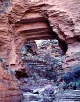
Royal arch route big pouroff bypass alternative to ledge route
References
Royal Arch Route Wikipedia(Text) CC BY-SA