
County McPherson FIPS code 20-61550 Elevation 408 m Area code 620 | Time zone CST (UTC-6) GNIS ID 477097 Local time Thursday 10:05 AM | |
 | ||
Weather 15°C, Wind S at 37 km/h, 75% Humidity | ||
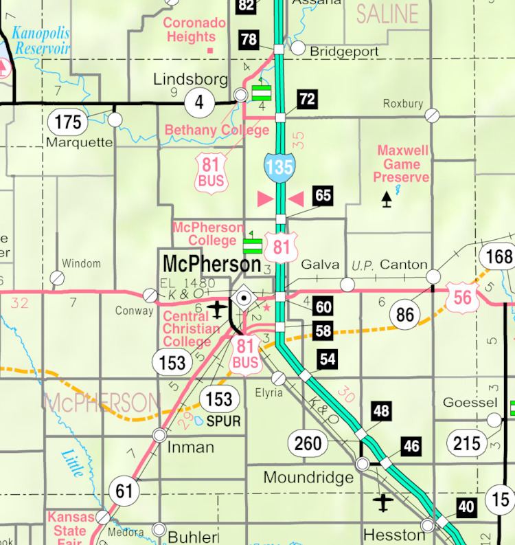
Roxbury is an unincorporated community and census-designated place about 14.8 miles east of Lindsborg in McPherson County, Kansas, United States. The population was 100 at the 1910 census.
Contents
Map of Roxbury, KS, USA
Early history
For many millennia, the Great Plains of North America was inhabited by nomadic Native Americans. From the 16th century to 18th century, the Kingdom of France claimed ownership of large parts of North America. In 1762, after the French and Indian War, France secretly ceded New France to Spain, per the Treaty of Fontainebleau.
19th century
In 1802, Spain returned most of the land to France. In 1803, most of the land for modern day Kansas was acquired by the United States from France as part of the 828,000 square mile Louisiana Purchase for 2.83 cents per acre.
In 1854, the Kansas Territory was organized, then in 1861 Kansas became the 34th U.S. state. In 1867, McPherson County was established within the Kansas Territory, which included the land for modern day Moundridge.
The original name for the area was Colfax, which was established in 1871 as a trading post. It was renamed to Roxbury on March 4, 1875 due to an act of legislature.
Education
Roxbury is a part of USD 400 Smoky Valley Public Schools.
Roxbury schools were closed in 1965 through school unification. The Roxbury High School mascot was Roxbury Lions.