Trisha Shetty (Editor)

Route 1 (Uruguay)

Updated on
Edit
Like
Comment
Share on FacebookTweet on TwitterShare on LinkedInShare on Reddit
West end:
  
Colonia del Sacramento

Length
  
177 km

Route 1 (Uruguay)

East end:
  
Montevideo (Bella Vista)

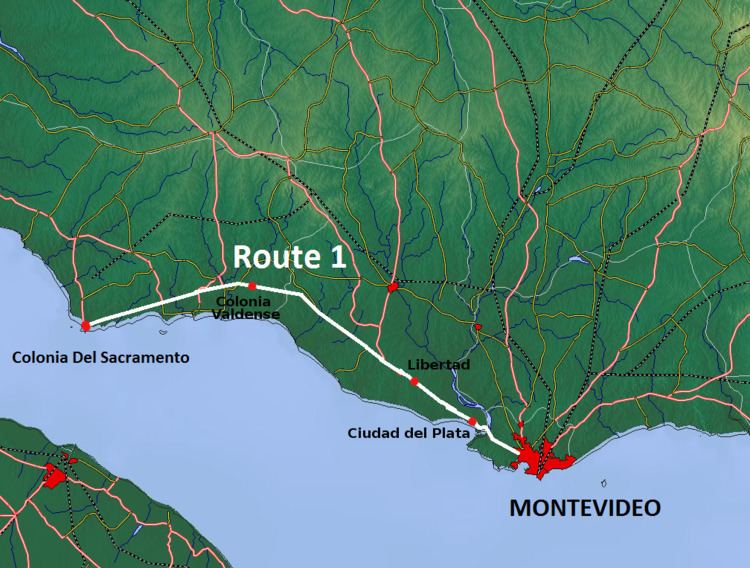
Route 1 is a national route of Uruguay. In 1975, it was assigned the name Brigadier General Manuel Oribe, a national hero of Uruguay. It connects Montevideo with Colonia del Sacramento to the west along the coast. The road is approximately 177 kilometres (110 mi) in length.

Contents

Map of 1, Uruguay

The distance notation along Route 1 uses the same Kilometre Zero reference as Routes 3, 5, 6, 7, 8, 9 and IB, which is the Pillar of Peace of Plaza de Cagancha in the Centro of Montevideo.

Route 1 crosses the Santa Lucia River on the border between the departments of Montevideo and San Jose along a modern 4-lane bridge with a length of 800 metres. It was crossed by the old 2-lane bridge opened in 1925 on the old Route 1, which still exists today and is used as a shortcut by the people of Santiago Vázquez.

Destinations and junctions

These are the populated places Route 5 passes through, as well as its main junctions with other National Roads.

Montevideo Department
  • Km. 9 La Paloma - Tomkinson, Route 5 North to Canelones, Florida, Durazno, Tacuarembó and Rivera.
  • San José Department
  • Km. 52 Libertad, Route 45 North to Rodríguez
  • Km. 61 (6.5 km after Puntas de Valdez), Route 3 North to San José, Trinidad, Young, Paysandú, Salto and Bella Unión.
  • Km. 101 Ecilda Paullier, Route 11 East to San José de Mayo, Canelones, Atlántida and Route IB
  • Colonia Department
  • Km. 127 (7 km after Colonia Valdense), Route 2 North to Rosario, Cardona, and the Northwest to Mercedes, Fray Bentos and Route 136 of Argentina.
  • Km. 137 (17 km after Colonia Valdense), Route 54 South to Juan Lacaze, Route 54 North to Route 12.
  • Km. 148 (28 km after Colonia Valdense), Route 22 North to Tarariras and then Northwest to Route 21.
  • Km. 163 (43 km after Colonia Valdense), Route 50 Northeast to Tarariras
  • Km. 177 Ends into Avenida Franklin D. Roosevelt of Colonia del Sacramento.
  • References

    Route 1 (Uruguay) Wikipedia


    Similar Topics