
Founded 1680 Elevation 27 m (89 ft) Population 26,231 (2011) | Founded by Manuel Lobo Time zone UTC -3 Local time Thursday 4:29 AM | |
 | ||
Weather 22°C, Wind N at 16 km/h, 91% Humidity Points of interest Portón de Campo, Museo Portugués, Basílica del Santísimo Sacrame, Museo del Azulejo, Museo Municipal | ||
Colonia del sacramento uruguay 2
Colonia del Sacramento ([koˈlonja ðel sakɾaˈmento]; formerly the Portuguese Colónia do Sacramento) is a city in southwestern Uruguay, by the Río de la Plata, facing Buenos Aires, Argentina. It is one of the oldest towns in Uruguay and capital of the Colonia Department. It has a population of around 27,000.
Contents
- Colonia del sacramento uruguay 2
- Map of 70000 Col Del Sacramento Colonia Department Uruguay
- History
- Timeline of rule
- Population
- Climate
- Urban fabric
- Points of interest
- Gallery
- Transportation
- Consular representation
- Twin townsister city
- References
Map of 70000 Col Del Sacramento, Colonia Department, Uruguay
It is renowned for its historic quarter, a UNESCO World Heritage Site. Modern Colonia del Sacramento produces textiles and has a free trade zone, in addition to a polytechnic centre and various government buildings.
History
Founded in January 1680 by Portugal as Colónia do Sacramento, the colony was later disputed by the Spanish who settled on the opposite bank of the river at Buenos Aires. The colony was conquered by José de Garro in 1680, but returned to Portugal the next year. It was conquered again by the Spanish in March 1705 after a siege of five months, but given back in the Treaty of Utrecht. Another attack during the Spanish-Portuguese War, 1735-1737, failed.
It kept changing hands from crown to crown due to treaties such as the Treaty of Madrid in 1750 and the Treaty of San Ildefonso in 1777, until it remained with the Spanish. It then transferred to Portuguese control again, being later incorporated into Brazil after 1816, when the entire Banda Oriental (Uruguay) was seized by the government of the United Kingdom of Portugal, Brazil and the Algarves and renamed the Cisplatina province.
On 10 January 1809, before the independence of Uruguay, it was designated as a "Villa" (town) and has since been elevated to the status of "Ciudad" (city).
Since independence, Colonia del Sacramento has expanded to the north and east, but the original Bairro Histórico (historic quarter in Portuguese or Barrio Histórico, current Spanish spelling) retains its irregular, terrain-fitting street plan built by the Portuguese, contrasting with the wider, orthogonal calles in the newer Spanish area.
Timeline of rule
The rule from 1680 to present (with flag of the period) is:
Population
In 2011 Colonia del Sacramento had a population of 26,231.
Source: Instituto Nacional de Estadística de Uruguay
Climate
Colonia del Sacramento has a mild humid subtropical climate, described by the Köppen climate classification as Cfa. Summers are warm and winters are cool, with relatively frequent frosts and fog. The precipitation is evenly distributed throughout the year, with an average of 1,039 mm (40.91 in), and the annual average temperature is 17 °C (63 °F).
Urban fabric
The city was developed on a peninsula that protrudes into the Río de la Plata. The 16 hectare "Barrio Histórico", or Portuguese Old City, was enclosed by a fortification wall across the peninsula in the site of present-day Calle Ituzaingó. Most of the fortification wall was removed in 1777 and the remaining parts in 1859. The Portuguese part of the city has an irregular street network.
Outside the wall, the historical part of the city was planned in Spanish colonial style and in the characteristic checkerboard layout.
Points of interest
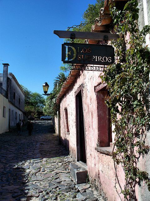
The Barrio Histórico (historic quarter) section of Colonia del Sacramento is designated a World Heritage Site by UNESCO. It is a popular tourist attraction for visitors from Buenos Aires, and there is frequent ferry service across the Río de la Plata between the two cities, with fast ferries completing the journey in just 50 minutes. The historical section of Colonia, which has some cobblestone streets built by the Portuguese in the 17th century, is within walking distance of the ferry terminal. Among the notable tourist attractions around the tree-lined Plaza Mayor (main square) are:
Gallery
Transportation
Colonia del Sacramento is served by three ferry boat lines from Buenos Aires, Argentina: "Buquebus", "Seacat Colonia" and "Colonia Express".
Two principal highways end in Colonia: Route 1 connects Colonia to Montevideo and points east; Route 21 connects to points north, including the Aarón de Anchorena National Park, 30 kilometres (19 mi) distant, and Fray Bentos. There is also a local airport for small planes. There is a project in process to lengthen the runway and begin commercial flights to Buenos Aires (this was done in the past) and other cities within Uruguay.
The city is served by Laguna de los Patos International Airport located 17 km from Colonia along Route 1.
Consular representation
Argentina and Portugal both maintain a consulate in Colonia del Sacramento.