
Country France Intercommunality La Tinée Area 40.3 km² Population 167 (1999) | Department Alpes-Maritimes Time zone CET (UTC+1) Local time Thursday 10:57 AM Arrondissement Nice | |
 | ||
Region Provence-Alpes-Côte d'Azur Canton Saint-Sauveur-sur-Tinée Weather 6°C, Wind SE at 6 km/h, 100% Humidity | ||
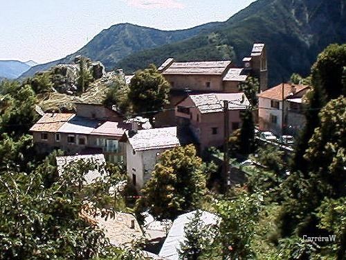
Roure is a commune located in the department of Alpes-Maritimes department in southeastern France in the Provence-Alpes-Côte d'Azur. Its inhabitants are called Rourois. It is a medieval village with agro-pastoral architecture.
Contents
Map of 06420 Roure, France
Geography
The village is situated at the entrance of the Tinée Valley, at the edge of the Mercantour National Park, at an elevation of 1100 m. The village is accessible by road from Nice through the RN 202, towards Digne then 2205 RD, the RD 30 and RD 130. Also by path through the GR 5. The village contains five little villages: Rougios, lost in the mountains, Tiecs, la Cerise, Puch and Valabres where there was a priest and a school until 1904.
Toponymy
The first indication of the village dates from 1067 under the name "Rora", derived from the Latin word "robur" which means "oak". Villagers raised and tended cows and goat herds on behalf of their owners and concluded business under a large oak tree. Hence, the origin of the village’s name.