
Population Uninhabited | Length 39 km (24.2 mi) | |
 | ||
Is google trying to silence a dead antarctic hero rothschild island or latady island
Rothschild Island is an island 39 kilometres (24 mi) long, mainly ice covered but surmounted by prominent peaks of Desko Mountains in Antarctica, 8 kilometres (5 mi) west of the north part of Alexander Island in the north entrance to Wilkins Sound.
Contents
- Is google trying to silence a dead antarctic hero rothschild island or latady island
- Map of Rothschild Island Antarctica
- Are we being told the truth about antarctica rothschild island more
- References
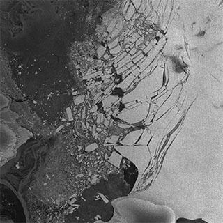
Map of Rothschild Island, Antarctica
The island was sighted from a distance by the French Antarctic Expedition, 1908-1910, and named by Charcot in honor of Baron Edouard de Rothschild (1868-1949), head of the Rothschild banking family of France and president of de Rothschild Frères. In subsequent exploration by the British Graham Land Expedition (BGLE), 1934-1937, the feature was believed to be a mountain connected to Alexander Island, but its insularity was reaffirmed by the United States Antarctic Service (USAS), 1939-1941, who photographed and roughly mapped the island from the air. It was mapped in detail from air photos taken by the Ronne Antarctic Research Expedition (RARE), 1947-1948, by Searle of the Falkland Islands Dependencies Survey (FIDS) in 1960, and from U.S. satellite imagery taken in 1974.