
Elevation 30 m (100 ft) Population 21,951 (31 Dec 2008) | Founded 1195 Time zone CET/CEST (UTC+1/+2) Local time Thursday 6:04 AM | |
 | ||
Weather 4°C, Wind NE at 11 km/h, 71% Humidity Points of interest Stadtkirche, Cohn‑Scheune Rotenburg, Großes und Weißes M, Rudolf Schäfer Haus, Pferdebrunnen | ||
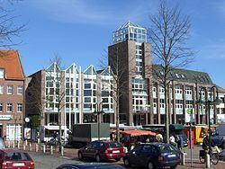
Rotenburg an der Wümme (until May 1969: Rotenburg in Hannover) is a town in Lower Saxony, Germany. It is the capital of the district of Rotenburg.
Contents
- Map of 27356 Rotenburg Germany
- Geography
- History
- Swedish period
- Later history
- Mayor
- Sights
- Education
- Twinning
- Sons and daughters of the town
- References
Map of 27356 Rotenburg, Germany
Geography
Rotenburg is situated at the Wümme river, which in turn lies between the rivers Elbe and Weser at about the same latitude as Hamburg and Bremen, the latter lying 40 km to the west. It is often called "Rotenburg (Wümme)" in order to distinguish it from the town Rotenburg an der Fulda in Hesse and Rothenburg ob der Tauber in Bavaria.
History
The town was founded in 1195, when the Prince-Bishop Rudolf I of Verden built a castle at the place. Then the town belonged to the Prince-Bishopric of Verden, established in 1180. The castle took its name from the colour of the bricks (rot means "red", Burg "castle"). The adjoining settlement remained a tiny village until the 19th century.
In 1648 the Prince-Bishopric was transformed into the Principality of Verden, which was first ruled in personal union by the Swedish Crown - interrupted by a Danish occupation (1712–1715) - and from 1715 on by the Hanoverian Crown.
Swedish period
After the Thirty Years' War, the rule of the Bishops of Verden ended and Rotenburg went into the now secularized Duchy of Verden under Swedish rule. In this period its new rulers built the castle with the remnants of the schloss into a modern fortress as an outpost to protect the main fortress at Stade. This rebuilding work required the western part of the town to be demolished, making it necessary to move the main area of settlement to the east. Even the parish church had to be taken down and moved to the site of the present town church.
In the Swedish-Brandenburg War from 1675 to 1676 the town was captured during a military campaign by an alliance of Denmark and several states of the Holy Roman Empire, and it remained in Allied hands until the end of the war in 1679. In the wake of the Treaty of Saint Germain in 1679 Rotenburg was returned to Sweden.
The fortress remained in operation until ca. 1680. After that it was neglected, the building was torn down and only the fortifications modernized in places. After 1843 the last ramparts were leveled. In its place today is the terrain of the old local history museum. In the period between 1626 and 1835 there were seven town fires, of which several destroyed the entire building stock. Swedish rule lasted until the town was captured by Denmark in 1712.
Later history
The Kingdom of Hanover incorporated the Principality in a real union and the princely territory, including Rotenburg upon Wümme, became part of the new Stade Region, established in 1823. In 1866, Prussia annexed the territory from Hannover. As a consequence, Rotenburg was called Rotenburg in Hannover. In May 1969, town and district changed the name to "Rotenburg an der Wümme". In 2006 during the World Cup Rotenburg hosted the national team from Trinidad and Tobago.
Mayor
The mayor of Rotenburg (Wümme) is Andreas Weber (SPD). He was elected in 2014 with 59,6 % of the vote. The poll was 55,8 %.