
Country United States FIPS code 47-65240 Elevation 95 m Local time Wednesday 9:40 PM Area code 901 | Time zone Central (CST) (UTC-6) GNIS feature ID 1300138 Zip code 38066 Population 679 (2013) | |
 | ||
Weather 12°C, Wind NE at 10 km/h, 39% Humidity Area 13.21 km² (12.95 km² Land / 21 ha Water) | ||
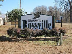
Rossville is a town in Fayette County, Tennessee, United States. The population was 664 at the 2010 census, up from 380 at the 2000 census.
Contents
Map of Rossville, TN 38066, USA
Geography
Rossville is located in southwestern Fayette County at 35°2′38″N 89°32′35″W (35.043935, -89.542931). It is bordered to the west by the city of Piperton and to the south by Marshall County, Mississippi.
According to the United States Census Bureau, the town has a total area of 1.8 square miles (4.7 km2), of which 1.7 square miles (4.4 km2) is land and 0.1 square miles (0.26 km2) (2.82%) is water. The Wolf River, a tributary of the Mississippi River, flows to the west along the northern edge of the town.
Major thoroughfares
Rossville sits along the Norfolk Southern Railway. A new intermodal facility has been built southwest of the town and opened in 2012.
Demographics
As of the census of 2010, there were 664 people, 275 households, and 196 families residing in the town. The population density was 220.6 people per square mile (85.3/km²). There were 182 housing units at an average density of 105.6 per square mile (40.9/km²). The racial makeup of the town was 72.37% White, 25.00% African American, 0.53% Native American, and 2.11% from two or more races. Hispanic or Latino of any race were 0.53% of the population.
There were 164 households out of which 28.0% had children under the age of 18 living with them, 54.3% were married couples living together, 8.5% had a female householder with no husband present, and 36.6% were non-families. 34.8% of all households were made up of individuals and 17.1% had someone living alone who was 65 years of age or older. The average household size was 2.32 and the average family size was 2.99.
In the town, the population was spread out with 23.7% under the age of 18, 5.3% from 18 to 24, 33.9% from 25 to 44, 21.8% from 45 to 64, and 15.3% who were 65 years of age or older. The median age was 35 years. For every 100 females there were 89.1 males. For every 100 females age 18 and over, there were 77.9 males.
The median income for a household in the town was $33,333, and the median income for a family was $48,929. Males had a median income of $33,036 versus $25,781 for females. The per capita income for the town was $17,735. About 8.9% of families and 12.1% of the population were below the poverty line, including 9.0% of those under age 18 and 12.2% of those age 65 or over.
Notable people
Compton Newby Crook, who wrote science fiction under the pseudonym Stephen Tall, was born in Rossville.
Delta Blues legend and master of the bottleneck guitar Mississippi Fred McDowell was born here before moving to Mississippi.