
Founded September 29, 1824 Area 1,828 km² Unemployment rate 5.8% (Apr 2015) | Website fayettetn.us Population 38,690 (2013) | |
 | ||
Cities Somerville, Oakland, Rossville, Piperton, Gallaway, Williston, Moscow, Hickory Withe, La Grange, Braden Rivers Wolf River, Loosahatchie River, Cypress Creek | ||
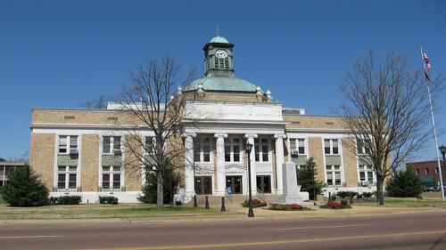
Freedom s front line fayette county tennessee
Fayette County is a county located in the U.S. state of Tennessee. As of the 2010 census, the population was 38,413. Its county seat is Somerville. The county was named after the Marquis de la Fayette, French hero of the American Revolution.
Contents
- Freedom s front line fayette county tennessee
- Map of Fayette County TN USA
- Geography
- Adjacent counties
- State protected areas
- Demographics
- References
Map of Fayette County, TN, USA
Fayette County is part of the Memphis, TN–MS–AR Metropolitan Statistical Area. It is considered part of the Mississippi Delta and was a major area of cotton plantations dependent on slave labor in the nineteenth century.
Rhea "Skip" Taylor is currently the county mayor. Fayette County has a 19 person legislative body referred to as the Board of County Commissioners. All positions are elected every four (4) years along with the County Mayor.
Geography
According to the U.S. Census Bureau, the county has a total area of 706 square miles (1,830 km2), of which 705 square miles (1,830 km2) is land and 1.5 square miles (3.9 km2) (0.2%) is water. It is the third-largest county in Tennessee by area.
Adjacent counties
State protected areas
Demographics
As of the census of 2000, there were 28,806 people, 10,467 households, and 8,017 families residing in the county. The population density was 41 people per square mile (16/km²). There were 11,214 housing units at an average density of 16 per square mile (6/km²). The racial makeup of the county was 62.48% White, 35.95% Black or African American, 0.19% Native American, 0.22% Asian, 0.01% Pacific Islander, 0.39% from other races, and 0.76% from two or more races. 1.03% of the population were Hispanic or Latino of any race.
According to the census of 2000, the largest ancestry groups in Fayette County were English 51.66%, African 35.95%, Scots-Irish 7.1%, and Scottish 1.2%.
By 2005 Fayette County was 67.9% non-Hispanic whites. Its population was 28.2% African-American, 1.9% Latino and 1.2% Asian.
In 2000 there were 10,467 households out of which 31.00% had children under the age of 18 living with them, 58.50% were married couples living together, 14.00% had a female householder with no husband present, and 23.40% were non-families. 20.50% of all households were made up of individuals and 8.60% had someone living alone who was 65 years of age or older. The average household size was 2.71 and the average family size was 3.14.
In the county, the population was spread out with 25.70% under the age of 18, 8.20% from 18 to 24, 27.40% from 25 to 44, 25.60% from 45 to 64, and 13.00% who were 65 years of age or older. The median age was 38 years. For every 100 females there were 96.50 males. For every 100 females age 18 and over, there were 92.20 males.
The median income for a household in the county was $40,279, and the median income for a family was $46,283. Males had a median income of $33,603 versus $24,690 for females. The per capita income for the county was $17,969. About 10.90% of families and 14.30% of the population were below the poverty line, including 18.40% of those under age 18 and 18.00% of those age 65 or over.
Since the four-lane expansion of Highway 64 in the early 1990s, western Fayette County has had a population explosion. Although the county seat is still in Somerville, the population of Oakland has far surpassed it because of the influx of people working in Shelby County and seeking more affordable housing.
Although Fayette County is growing on its western side, the county's economy is still based on agriculture. Historically it was a site of cotton plantations as part of the Mississippi Delta. Several of the county's largest farmers, including the Rhea, Walker, German, Armour, and Karcher families, control the vast majority of the county's wealth. Some of these families have been farming for generations dating back to plantations before the Civil War. Others are younger farmers who have used their skill, business savvy, and work ethic to develop large farming operations.
Fayette County has become a destination for upscale residential housing outside of Memphis and Shelby County, TN, for high income families of the metro area. The total value for building permits in June 2007 was close to that of the much larger Memphis suburban area of DeSoto County, Mississippi.