
Country United States Incorporated (borough) 1876 Elevation 409 m Founded 1876 Population 192 (2013) | Settled 1806 Time zone Eastern (EST) Area 130 ha Local time Wednesday 7:07 PM Area code 570 | |
 | ||
Weather -4°C, Wind N at 21 km/h, 33% Humidity | ||
Roseville is a borough in Tioga County, Pennsylvania, in the United States. The population was 189 at the 2010 census.
Contents
Map of Roseville, PA, USA
History
Roseville was first settled by its namesake, Dr. William Rose in 1806. Dr. Rose migrated to Tioga County from Rutland (town), Vermont. He served as a frontier doctor for the citizens of eastern Tioga and western Bradford Counties. Rose built a distillery at Roseville in 1822, soon after his son, William Rose Jr., opened a tavern. The tavern quickly became the center of commerce in Roseville. The tavern was replaced by a hotel built to serve the needs to travelers between Mansfield and Elmira, New York.
Roseville was home to several businesses that served the needs of the people of Tioga County during the late 1800s and early 1900s. A gristmill was opened as was a cheese factory and a paint plant, but the principal form of business remained in the taverns along the highway. A devastating fire in 1888 destroyed 23 buildings in Roseville, thus ended the tavern era.
Roseville formerly had a post office and a public school. The post office, Rutland Post Office, was closed in 1957. The public school was closed in 1966 when Roseville's school system became part of the Mansfield school system which later was consolidated into the Southern Tioga School District.
Geography
Roseville is located at 41°51′51″N 76°57′34″W (41.864305, -76.959348).
According to the United States Census Bureau, the borough has a total area of 0.5 square miles (1.3 km2), all of it land.
Roseville is surrounded by Rutland Township.
Demographics
As of the census of 2010, there were 189 people, 75 households, and 57 families residing in the borough. The population density was 390.0 people per square mile (150.8/km²). There were 84 housing units at an average density of 158.3 per square mile (61.2/km²). The racial makeup of the borough was 97.58% White, 0.48% Native American, 0.97% Asian, and 0.97% from two or more races. Hispanic or Latino of any race were 0.48% of the population.
There were 75 households out of which 32.0% had children under the age of 18 living with them, 58.7% were married couples living together, 12.0% had a female householder with no husband present, and 22.7% were non-families. 16.0% of all households were made up of individuals and 4.0% had someone living alone who was 65 years of age or older. The average household size was 2.76 and the average family size was 3.02.
In the borough the population was spread out with 28.0% under the age of 18, 9.7% from 18 to 24, 23.2% from 25 to 44, 30.0% from 45 to 64, and 9.2% who were 65 years of age or older. The median age was 34 years. For every 100 females there were 99.0 males. For every 100 females age 18 and over, there were 86.3 males.
The median income for a household in the borough was $27,188, and the median income for a family was $24,821. Males had a median income of $31,500 versus $21,667 for females. The per capita income for the borough was $11,683. About 10.5% of families and 14.1% of the population were below the poverty line, including 28.8% of those under the age of eighteen and none of those sixty five or over.
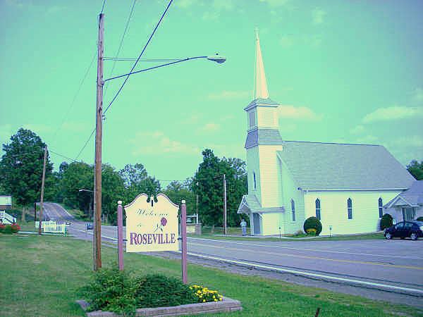
Churches
Visitors will notice two churches that are located in Roseville. One is the Roseville Methodist Church and the other is the Independent Baptist Church.