
Time zone CET (UTC+1) Area 30 km² Dialling code 0981 | Demonym(s) Rosetani Elevation 217 m Local time Wednesday 11:53 PM Postal code 87070 | |
 | ||
Frazioni Centro,Borgata Marina,Villaggio Baiabella Weather 15°C, Wind W at 10 km/h, 65% Humidity | ||
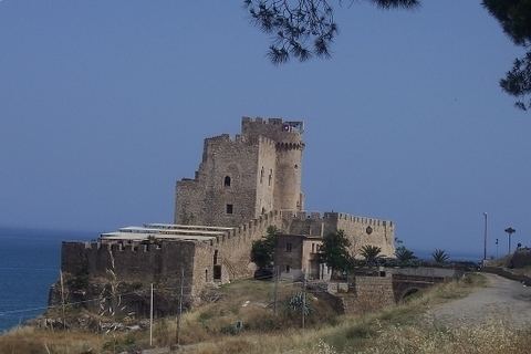
Roseto capo spulico castello federiciano
Roseto Capo Spulico is a town and comune of the province of Cosenza in the Calabria region of southern Italy. Roseto was originally one of the satellite cities of Sybaris, at the time of Magna Grecia; it is the coastal areas of Southern Italy on the Tarentine Gulf that were extensively populated by Greek settlers.
Contents
- Roseto capo spulico castello federiciano
- Map of 87070 Roseto Capo Spulico Province of Cosenza Italy
- References
Map of 87070 Roseto Capo Spulico Province of Cosenza, Italy
Roseto Capo Spulico was named after the roses that were cultivated there.
The petals were used to fill the mattresses on which the sybaritic slept. The Rose Garden today was born in the tenth century AD and reached its peak in 1260 when the Castrum Petrae Roseti (castle of Roseto) was built. It is also known for The Church of the Immaculate Conception, built in the 15th century, a rustic, masonry church that sits on the edge of a cliff.
As a tourist destination, Roseto is known for its beaches and seaside resorts.