
Type Rural road Length 298 km | ||
 | ||
Major settlements Elsey National Park, Roper Bar, Ngukurr | ||
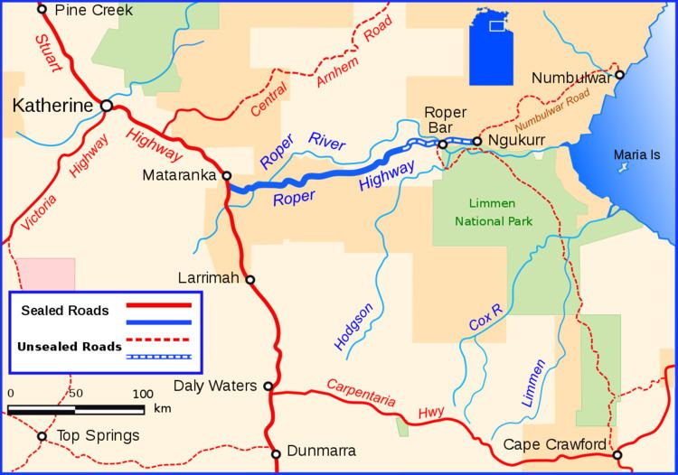
The Roper Highway is a road in the Northern Territory of Australia that begins from a point on the Stuart Highway 7 kilometres south of Mataranka, and runs east along the Roper River via Roper Bar to Ngukurr. Its length is 206 kilometres. From Ngukurr the road continues for approximately 153 kilometres to Numbulwar on the Gulf of Carpentaria as the Numbulwar Road. The section of the highway between Roper Bar and Ngukurr is also known as the Ngukurr Access.
Map of Roper Hwy, Northern Territory, Australia
References
Roper Highway Wikipedia(Text) CC BY-SA