
Local time Wednesday 1:23 PM | ||
 | ||
Weather 4°C, Wind E at 27 km/h, 92% Humidity | ||
Rookhope is a village in County Durham, in England. A former lead and fluorspar mining community, it first existed as a group of cattle farms in the 13th Century. It is situated in the Pennines to the north of Weardale. W. H. Auden once called Rookhope 'the most wonderfully desolate of all the dales'. In the 2001 census Rookhope had a population of 267. The village pub, the Rookhope Inn and the Swallow's Rest on the fell surrounding Rookhope are popular with cyclists on the coast to coast cycling route which runs from Sunderland on the east coast to Whitehaven on the west coast of northern England.
Contents
Map of Rookhope, Bishop Auckland, UK
Rookhope Arch
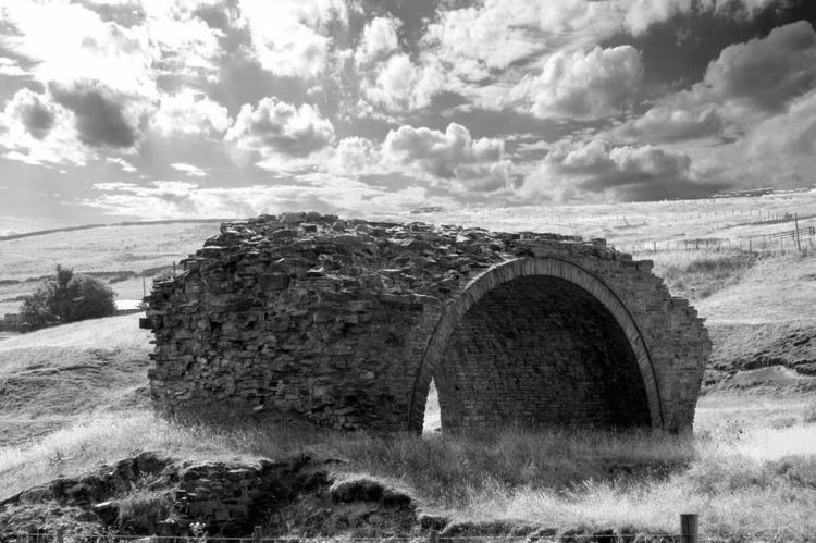
A local landmark is the Rookhope Arch at Lintzgarth, a few hundred yards west up the valley; one of the few remaining parts of the two mile (3 km) Rookhope Chimney. This "horizontal" chimney (parallel to the ground, which actually rises steeply to the moors) was used to carry poisonous flue gases from the Rookhope lead smelting works up onto the high moor. Periodically, lead and silver carried over in the gases and deposited in the chimney were dug out and recovered, rather than going to waste.
St John the Evangelist church
St John the Evangelist Church was built in 1905. It is a Grade 2 listed building. In August 2014 the church was being sold.