Suvarna Garge (Editor)

Romsdalsalpane

Updated on
Edit
Like
Comment
Share on FacebookTweet on TwitterShare on LinkedInShare on Reddit
Peak
  
Store Venjetind

County
  
Møre og Romsdal

Highest point
  
Store Venjetinden

Country
  
Norway

Elevation
  
1,852 m

Romsdalsalpane wwwromsdalsalpenecomframsida1jpg

Mountains
  
Romsdalshornet, Store Venjetinden, Kyrkjetaket, Trollryggen, Store Trolltind

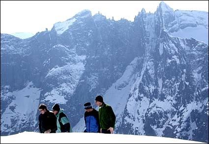
Romsdalsalpane is mountain range surrounding the Romsdalen valley in Møre og Romsdal county, Norway. They are primarily located in Rauma Municipality, Nesset Municipality, and Norddal Municipality. The southern part of the mountain range is also located within Reinheimen National Park. The famous Trollstigen road is runs over a pass in this mountain range.

Mountains in the range include:

  • Store Venjetind at 1,852 metres (6,076 ft)
  • Store Trolltind at 1,788 metres (5,866 ft), the highest point along the Troll Wall ridge
  • Trollryggen at 1,740 metres (5,710 ft)
  • Romsdalshorn at 1,550 metres (5,090 ft)
  • Kyrkjetaket at 1,439 metres (4,721 ft)
  • References

    Romsdalsalpane Wikipedia