
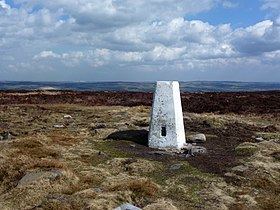
Prominence c. 244 metres (801 ft) Topo map OS Landranger 104 Listing Marilyn | OS grid SE114452 Elevation 402 m | |
 | ||
Location | ||
Rombalds Moor is an area of moorland in West Yorkshire, England, between the Airedale and Wharfedale valleys. The towns of Ilkley and Keighley lie to its northern and southern edges, respectively. The moor is sometimes referred to as Ilkley Moor, though technically this refers to the section of moor on the northern flank, above the town of Ilkley.
Contents
Geography
Rombalds Moor consists of several moors, usually named after the nearest town or village bordering it. These include (clockwise from North): Ilkley Moor, Burley Moor, Hawksworth Moor, Baildon Moor,
Etymology
The moor is said to be named after the local folklore legend of Rombald the Giant, though the name is likely to be a corruption of Romille, the moors surround Skipton having been given to Robert de Romille by William the Conqueror. Earlier Ordnance Survey maps show an earlier variant of the name as Rumbles Moor.