
Country United States Incorporated N/A Population 1,772 (2010) | Founded 1800s (approx) Time zone CST (UTC-6) Local time Wednesday 12:12 AM | |
 | ||
Weather 13°C, Wind NE at 21 km/h, 65% Humidity | ||
Romance christmas tree farm romance arkansas
Romance, Arkansas is an unincorporated community in west-central White County, Arkansas. The community is located approximately halfway between the town of Rose Bud to the north, and the unincorporated community of El Paso to the south. Alternately, the community is about 16 miles (26 km) northwest of Beebe, and less than 5 miles (8.0 km) east of Mount Vernon.
Contents
- Romance christmas tree farm romance arkansas
- Map of Romance AR 72136 USA
- Geography History
- Government
- Terrain Climate
- Transportation
- Early Childhood
- Elementary Secondary
- Colleges Universities
- Economy
- In Popular Culture
- References
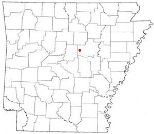
Map of Romance, AR 72136, USA
Considered as a postal designation (ZIP code: 72136), the population of Romance as of the 2010 census was 1,772 residents.
Geography & History
Lacking exact boundaries, much of the Romance area falls within the borders of Marshall Township and Kentucky Township within White County. As legend maintains, the community was named by a school teacher many years ago who thought the view from bluffs on the community's eastern side was particularly romantic. Romance has been noted for its unusual place name.
Naming of the community has proven significant in maintaining Romance's most visible business, a small branch post office of the United States Postal Service. The local post office is one of several within the USPS system that gain attention because of "love-themed" names, but received special focus in 1990 as the first location to issue that year's stamp in the USPS Love Stamp series. Romance's post office is among those popular around the United States for postmarks of cards for Valentine's Day, as well as for wedding invitations. A side venture of sorts has developed in recent years, with a small number of weddings performed on the grounds of the post office, though the practice is not affiliated with the USPS.
Government
As an unincorporated community, local government of Romance is part of the jurisdiction of the county judge of White County, the county's chief executive, and subject to county-wide ordinances. The current County Judge is Michael Lincoln of Searcy. The community is represented legislatively in the county's quorum court in Searcy, the county seat, during monthly and special meetings by the quorum court district's justice of the peace. The current JP for the area is Cameron Cooper of nearby Gravel Hill. Local law enforcement, similarly, is provided directly from the county level by deputies of the White County Sheriff's Department, as well as township constables for Marshall and Kentucky townships. The current Sheriff is Ricky Shourd and the current Constable is Curtis Elliot. Judicial enforcement is the responsibility of the circuit court judge and prosecuting attorney.
A small southern portion of the Romance area is federally controlled territory used as a parachute drop zone for Little Rock Air Force Base in Jacksonville; the base is approximately 33 miles (53 km) south of the territory. The drop zone was first established in the early 1980s.
Additionally, Romance is represented legislatively on the state level in the Arkansas General Assembly as part of Senate District 12 and House District 49; the community is part of Arkansas's 2nd Congressional District on the federal level.
Terrain & Climate
Small creeks and ponds can be found around the community, including Cedar Creek on Romance's south side. Clifty Creek flows through the center of Romance. Bad Luck Creek and Bayou Des Arc also flow nearby to the east, with Des Arc being dammed and forming Barnett Lake between Romance and the nearby community of Floyd. Scenic waterfalls can be found along these streams. There are a series of steep and elevated bluffs along Highway 31, with several pull off points to enjoy the scenic view. Geographically, Romance is considered to be in the foothills of the Ozark Mountains. The southern portion of the community, which is situated atop Black Jack Mountain, is significantly higher in elevation than other parts of Romance. The overall climate is somewhat similar to that found in other north central Arkansas communities, with warm, dry summers and cold, wet winters. Severe weather can include thunderstorms, hail, and tornados during the warm months, with snow, sleet, freezing rain and frigid windchills in the winter months.
Transportation
Romance is situated along two major Arkansas state highways:
The majority of roads in the area are administered by the White County Road Department, including Hilltop Acres, which serves the center of Romance and connects to both Arkansas 5 (opposite Manning Road) and Arkansas 31 (opposite Rogers Road). Passing by the former Romance Store building, which once housed the community's post office, the southern portion of Hilltop Acres travels through something of an unofficial downtown area. The post office was relocated to a lot along Arkansas 31 in the early 1990s; the remaining general store closed soon afterward.
Among county roads in the area, four major roads serve greater Romance:
The closest navigable waterway for commercial use is the Arkansas River at Little Rock. Commercial rail service is available in Little Rock and North Little Rock, with passenger rail service also in Little Rock. The nearest airfield is Dennis F. Cantrell Field in Conway, offering charter service at Conway Municipal Airport (CWS). Major airlines and air freight service are available in Little Rock at Little Rock National Airport (LIT), Adams Field.
Early Childhood
Education for children in Romance prior to the age of 5 years is primarily home-based, though a limited amount of day-care facilities can be found within short drives from the community.
Elementary & Secondary
Children in the greater Romance area are largely served by the Rose Bud Public School District in nearby Rose Bud. Romance's school district was consolidated with the Rose Bud district during the 1950s, and the community had a local school as early as 1895, when the Harper School on Blackjack Mountain operated. Extreme eastern portions of the community are part of the Beebe Public School District. Both are member schools of the Beebe-based Wilbur D. Mills Educational Service Cooperative. Far western portions of the area are part of the Mount Vernon-Enola Public School District, part of the Arch Ford Educational Service Cooperative based in Plumerville.
Colleges & Universities
Seven post-secondary institutions of higher learning are located within a 45-mile (72 km) radius of Romance:
Economy
Few businesses are found in Romance, with commuting to jobs in surrounding communities being very common. The average travel time from home to work as of 2000 is typically around 44 minutes, according to research from the U.S. Census Bureau. Those businesses most easily identified, other than the USPS, include hay and grass farming, raising of livestock, meat processing, and antique and craft sales. The Romance area is also part of the Fayetteville Shale Play, a region for natural gas resource exploration throughout northern Arkansas since 2005.
In Popular Culture
During early 2012, the Animal Planet series American Stuffers chronicled the owner and staff of Xtreme Taxidermy, a Romance area taxidermy shop specializing in pet preservation located approximately two miles south of Blackjack Mountain Road along Arkansas Highway 5.