
ZIP code 80474 Elevation 2,583 m Population 181 (2010) | Time zone MST (UTC-7) GNIS feature ID 0202787 Area 3.66 km² Local time Tuesday 12:59 PM | |
 | ||
Weather 11°C, Wind W at 8 km/h, 40% Humidity | ||
Rollinsville colorado
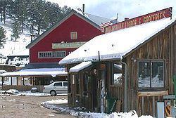
Rollinsville is a census-designated place and a U.S. Post Office located in Gilpin County, Colorado, United States. It is located in the mountains southwest of the city of Boulder, on the flank of a hill above South Boulder Creek along State Highway 119 between Nederland and Black Hawk. It consists of a small cluster of residences and several businesses at the terminus of the road leading westward up to Rollins Pass at the summit of the Front Range. The population as of the 2010 Census was 181. The Rollinsville post office has the ZIP Code 80474.
Contents
Map of Rollinsville, CO 80474, USA
A post office called Rollinsville has been in operation since 1871. The community was named for John Q. A. Rollins, a prominent mining executive in Gilpin County in the 1860s and 1870s.
Geography
Rollinsville is located in northern Gilpin County at 39°54′59″N 105°30′03″W (39.916320,-105.500851), along Colorado State Highway 119, the Peak to Peak Highway. It is 5 miles (8 km) south of Nederland and 14 miles (23 km) north of Black Hawk.
The South Fork of Boulder Creek flows just south of the town. The creek follows the railroad tracks into a small canyon and emerges near the Boulder/Gilpin county border before flowing through Pinecliffe, Colorado.