
 | ||
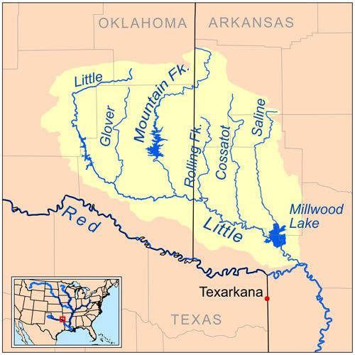
Rolling Fork is a 55.4-mile-long (89.2 km) river in southwest Arkansas. It is dammed by DeQueen Dam and forms DeQueen Lake. It is a tributary of the Little River, running parallel with other tributaries such as the Cossatot River, the Saline River, the Mountain Fork, and the Glover River. It is part of the Mississippi watershed.
Contents
Map of Rolling Fork, Ozark Township, AR, USA
Location
Course
Rolling Fork starts near Hatton, Arkansas. It flows south through Wickes and Grannis. About ten miles from its source Rolling Fork flows into DeQueen Lake, a man-made reservoir. Near Chapel Hill and DeQueen, Arkansas, Rolling Fork exits the lake and continues until it reaches the Little River.
References
Rolling Fork (Arkansas) Wikipedia(Text) CC BY-SA