
Elevation 210 m Local time Tuesday 4:39 PM | Postal code 751 04 Area 8.06 km² | |
 | ||
Weather 14°C, Wind SW at 10 km/h, 51% Humidity | ||
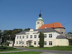
Rokytnice is a village and municipality (obec) in Přerov District in the Olomouc Region of the Czech Republic.
Map of 751 04 Rokytnice, Czechia
The municipality covers an area of 8.06 square kilometres (3.11 sq mi), and has a population of 1,409 (as at 3 July 2006).
Rokytnice lies approximately 5 kilometres (3 mi) west of Přerov, 18 km (11 mi) south-east of Olomouc, and 224 km (139 mi) east of Prague.
References
Rokytnice (Přerov District) Wikipedia(Text) CC BY-SA