
Elevation 28 m (92 ft) Postcode 6060–6065, 6074–6077 Area 44.37 km² Local time Tuesday 11:30 AM Team Oranje Blauw '15 | Established 1 January 1991 Time zone CET (UTC+1) Website www.roerdalen.nl Area code 0475 | |
 | ||
Weather 10°C, Wind W at 23 km/h, 72% Humidity | ||
Roerdalen ( pronunciation ) (Limburgish: Roerdale) is a municipality in the southeastern Netherlands, in the province of Limburg. As of 2007, it had about 21,000 inhabitants and borders Germany.
Contents
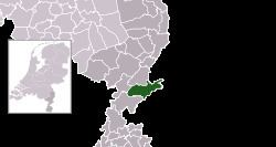
Map of Roerdalen, Netherlands
Population centres
Dutch Topographic map of the municipality of Roerdalen, June 2015
References
Roerdalen Wikipedia(Text) CC BY-SA