
Elevation 196 m | ||
 | ||
Similar Stenzelberg, Weilberg, Petersberg, Drachenfels, Dollendorfer Hardt | ||
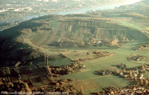
The Rodderberg is an extinct volcano in the east of the municipality of Wachtberg near Bonn, Germany. The last eruption was 250,000 years ago.
Contents
Map of Rodderberg, 53424 Remagen, Germany
It is situated just above the Rhine-valley. Together with the Drachenfels directly opposite, the Rodderberg narrows the Rhine-valley. This gorge portion is the southern limit of the lowland-bay of Cologne.
The Rodderberg offers views to the Siebengebirge, the Rhine-valley and up to the Cologne Cathedral, about 50 km away.
GeologyEdit
The Rodderberg detonated in a phreatomagmatic eruption about 250,000 years ago. This happened when the magmatic plume reached the groundwater level of the Rhine (about 50m higher than today). After the explosion, the crater was filled with water that formed a maar of about 90 m depth. In the last 250,000 years this feature filled with dust and soil until it was filled up to today's level.
At present, all that is left of the old Volcano is just a small hill which has a shallow craterous form on its surface - if one doesn't know that it is a volcano, you would not see it.