
 | ||
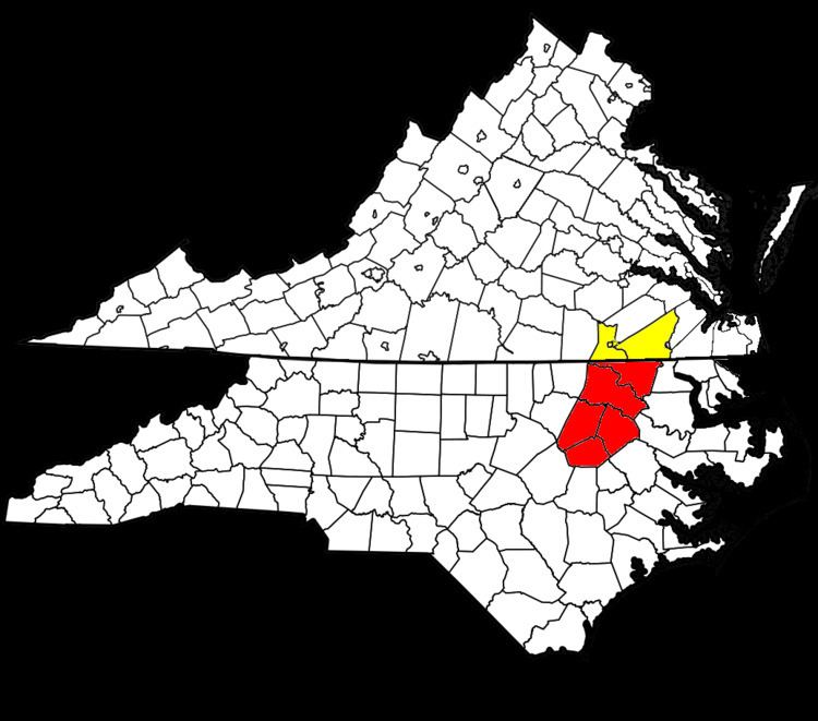
The Rocky Mount-Wilson-Roanoke Rapids Combined Statistical Area, as defined by the United States Census Bureau, is an area consisting of seven counties in Northeastern North Carolina and Southern Virginia. As of the 2010 census, the CSA had a population of 340,195 (though a July 1, 2009 estimate placed the population at 342,394).
Contents
Places with more than 50,000 inhabitants
Places with 5,000 to 15,000 inhabitants
Places with 1,000 to 5,000 inhabitants
Places with 500 to 1,000 inhabitants
Places with less than 500 inhabitants
Unincorporated places
Demographics
As of the census of 2010, there were 337,415 people, 227,224 households, and 189,653 families residing within the CSA. The racial makeup of the MSA was 91.49% White, 5.15% African American, 0.37% Native American, 0.56% Asian, 0.03% Pacific Islander, 1.33% from other races, and 1.06% from two or more races. Hispanic or Latino of any race were 3.15% of the population.
The median income for a household in the MSA was $34,921, and the median income for a family was $41,952. Males had a median income of $30,308 versus $23,069 for females. The per capita income for the MSA was $19,031.
Combined Statistical Area
The Rocky Mount-Wilson-Roanoke Rapids CSA is made up of Six counties in Northeastern North Carolina and Southern Virginia. The statistical area includes the Rocky Mount-Tarboro Metropolitan Statistical Area and the Roanoke Rapids Micropolitan Statistical Area.