
Area 3.581 km² | Phone +1 410-557-7994 | |
 | ||
Address 3318 Rocks Chrome Hill Rd, Jarrettsville, MD 21084, USA Hours Open today · 6AM–7PMTuesday6AM–7PMWednesday6AM–7PMThursday6AM–7PMFriday6AM–7PMSaturday(Maryland Day)6AM–7PMHours might differSunday6AM–7PMMonday6AM–7PMSuggest an edit Similar Patapsco Valley State Park, Jerusalem Mill, Susqueh State Park, Oregon Ridge Park Parking Lot, White Clay Creek State Park Profiles | ||
Rocks state park jarrettsville maryland
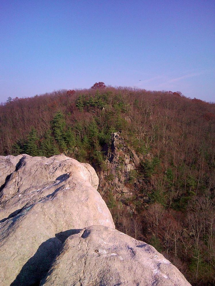
Rocks State Park is a public recreation area located in and around Deer Creek Valley near Pylesville, Harford County, Maryland. The state park's 1,060 acres (430 ha) preserve the geologic formation known as the King and Queen's Seat and other features in three non-contiguous areas near the junction of Maryland Route 24 and Maryland Route 165. It is managed by the Maryland Department of Natural Resources.
Contents
Drone footage elephant rocks state park yuneec q500 4k edition
History
The belief that the King and Queen's Seat rock formation was used by Native Americans for ceremonial purposes stems from a book published in 1880 by Thomas Wysong entitled The Rocks of Deer Creek: Their Legends and History. Wysong's account was written for "the young people especially,... mingling fact and fancy." An archaeological investigation by the Maryland State Highway Administration begun in 2005 failed to find evidence that the site had significance to modern Indians as a “traditional cultural property.” The “Rocks of Deer Creek” were already a tourist attraction in the 19th century, served by the Maryland and Pennsylvania Railroad at milepost 35.3 until 1958. The state purchased 82 acres at the site in 1948, opening it under the name Deer Creek State Park in 1952.
Park areas
Activities and amenities
The park offers scenic views on 3.5 miles (5.6 km) of hiking trails as well as tubing on Deer Creek and picnicking facilities with pavilions. Hunting and fishing are also available.
In popular culture
Kilgore Falls and the King and Queen's Seat rock formation were featured in the movie Tuck Everlasting.