
Population 573 (2011 census) | Postcode(s) 6330 Postal code 6330 | |
 | ||
Location 5.0 km (3 mi) from Albany | ||
Robinson is a western suburb of Albany in southern Western Australia, west of Albany's central business district. Its local government area is the City of Albany. The suburb has a median age of 43.
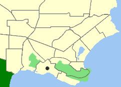
Map of Robinson WA 6330, Australia
Frenchman Bay Road passes through the suburb to Little Grove and then on to Torndirrup National Park and Frenchman Bay.
In March 2010, the area was evacuated as a result of a catastrophic bushfire. The fire started after a motorcycle accident and quickly spread through the surrounding bushland.
Fire fighters battled flames as high as 10 metres (33 ft) using two water bombers and a helicopter. The fire was eventually contained following overnight rain.
References
Robinson, Western Australia Wikipedia(Text) CC BY-SA