
 | ||
Roads in Portugal are defined by National Road Plan, which describes the existing and planned network of Portuguese roads.
Contents
- First road plans
- 1945 National Road Plan
- 1985 National Road Plan
- 2000 National Road Plan
- Autoestradas
- Tolls and taxation
- Itinerrios principais
- Itinerrios complementares
- Estradas nacionais
- Estradas regionais
- Estradas municipais
- Euro Routes
- References
The present plan in force is the 2000 National Road Plan (PRN 2000), approved in 1998. It has replaced the previous PRN 1985, which itself had replaced the PRN 1945.
The Portuguese road infrastructure is considered the best in Europe and the second best in the World by the World Economic Forum in its Global Competitiveness Report for 2014–2015.
The scenic road between Peso da Régua and Pinhão, in Northern Portugal, was considered the World Best Driving Road, accordingly to the Avis Driving Index. This road is a section of the N 222 which route follows the Douro Valley.
First road plans
The first real projects for road plans in Portugal date back from 1843 and 1848, and were based on 18th century plans which was based on connections between Lisbon and strategical points of the country, and as a support for fluvial routes. The precognized network was classified in 1850 as estradas (roads) and caminhos (paths), with the estradas being classified as 1st and 2nd class. Caminhos were routes of mere local interest.
In 1862, the roads (existing and projected) were classified as 1st class roads or estradas reais (royal roads), 2nd class roads or estradas distritais (district roads) and estradas municipais (municipal roads). The estradas reais were those with direct or indirect (via railways, for instance) origin in Lisbon) and the estradas municipais were those managed by the municipalities.
With the abolition of the Monarchy in 1910, the estradas reais were renamed estradas nacionais (national roads).
In 1913, the Law of 22 February establishes a commission to study the new classification of the roads and presents the guidelines to proceed to that classification. However, The new classification and road plan would only be established 13 years later.
Despite these efforts of a constitution of a road network, many routes were not clearly classified and the state of most roads was chaotic, and with the expansion of the automobile in the 1920s, new directions should be taken upon the Portuguese road network.
Finally in 1926, already under the Ditadura Nacional regime, a provisional General Plan of National Roads of 1st and 2nd class was established by the Decree nº 12 100 of 31 July 1926, accordingly to what was previewed by the Law of 22 February 1913. Both the 1st and 2nd class roads would be designated estradas nacionais, with the term estrada distrital disappearing. They would be designated EN xx-x, in a way that the number before the "-" designated the number of the road and suffix after the "-" identified its class. This plan established 23 roads of 1st class (designated EN 1-1ª to EN 23-1ª) and 112 roads of 2nd class (designated EN 1–2ª to EN 112-2ª). The General Plan of National Roads would be reviewed and definitely approved by the Decree nº 16 075 of 30 September 1928.
The 1st class national roads included in the 1926 General Plan of National Roads were the following:
By the Law nº 3 969 of 20 July 1927, the Junta Autónoma das Estradas (Autonomous Road Board) or JAE was created in order to study the state of the Portuguese road network. The preliminary report was clear to state that from the 16 000 km of the national road network, 4000 km were to be completed, and 10 000 km were in almost in ruin state.
The roads were then reclassified as estradas nacionais (1st and 2nd class), estradas municipais and caminhos públicos (public paths), the latter two under municipal management.
1945 National Road Plan
In 1933, the whole network (national and municipal) totalized 16900 km. The State recognized the importance of the road network and which led to the elaboration, in 1945, of the first real National Road Plan, the Plano Rodoviário Nacional de 1945 (PRN 45) defined in the Law nº 34 593 of 11 May 1945. By that date, the National and Municipal network, comprised 20500 km.
The PRN 1945, classified the national road network in Rede Fundamental (Fundamental Network) and Rede Complementar (Complementary Network), the latter served to support the fundamental network, the roads were classified according to the following:
The National Roads Statutes were subsequently approved in 1949.
In 1961, separate legislation (Law nº 2110, from 19 August 1961) on municipal roads defined new guidelines on construction, maintenance and commercialization of these roads, and those were classified as following:
The Main Roads could be, by law, upgraded into 4 lanes with central separation, if necessary. In fact this happened even before the PRN 1945 with the N7 motorway (nowadays A5) between Lisbon and the National Stadium, completed in 1944, and in 1961 with the first 25 km of N1 motorway (nowadays A1), between Lisbon and Vila Franca de Xira. The first urban highways have been built also in the 1960s.
The road classes where identified by colour codes: red for 1st class, blue for 2nd class, green for 3rd class, yellow for municipal roads and brown for municipal paths. These colors were applied in the bases of the location markers and occasionally in the background of the road numbers. The numbering distribution for main roads was according to the importance of its route in the network, and for N101 and over were numbered in a North to South growing fashion.
The extension of the roads had no relation with its class (except for branch roads, which were usually short distance), with existing 3rd class roads more than 100 km long, and main roads with as short as 8 km long, like the N7 highway, now part of A5. The longest road of the 1945 Plan was N2, connecting Chaves to Faro, extending for 738 km.
According PRN 1945, there were 18 Main Roads, designated N1 through N18.
1985 National Road Plan
From the 1960s and on, many routes started to be assumed as somewhat outdated, so in 1972, Brisa was set up in order to manage a projected network of motorways, which by that time didn't reach an extension of 100 km. New sections of motorways were then built in the 1970s and the early 1980s, like the Vila Franca de Xira-Carregado (1977), Carregado-Aveiras de Cima (1980), Condeixa-a-Nova-Mealhada (1982, which permitted bypassing the city centre of Coimbra), Santa Maria da Feira-Carvalhos (1980) and Albergaria-a-Velha-Santa Maria da Feira (1983) sections, all from what would become A1 motorway, as well as the extension of what would become A2 motorway into Setúbal (between 1978 and 1979).
However, the whole road network started to be assumed as more and more inadequate in order to properly serve the whole country.
In the eve of Portugal integration into EEC, the replacement for PRN 1945 comes to the light by the Law 380/85 of 25 September 1985, the Plano Rodoviário Nacional de 1985 (1985 National Roadway Plan) or PRN 1985.
The road network would be again composed by the Rede Fundamental (Fundamental Network), composed of nine itinerários principais (principal routes), designated IP1 through IP9, which totalized 2635 km:
The non-motorway sections of the itinerários principais started to be identified with green background direction signs and green background IPx road numbers. In the late 1990s, although the background of the direction signs continued to be green, the IPx road numbers started to be put on red background rectangles.
The itinerários principais were set to be of restricted access, forbidding pedestrian, animal and bicycle traffic, but exceptions could be accepted, specially for sections resulting from the reclassification of former national roads into IP network.
Such a classification was proposed before the publication of PRN 1985. In the early 1980s the first branches of the future IP routes were built, namely a 12 km loop road alternative to N16 between Mangualde and Prime (Viseu) for IP5 route, in 1983, and another branch, in 1981, at the time integrated on N2 route but later on IP3, between Oliveira do Mondego and Chamadouro when Aguieira Dam was built.
The road network was composed also by the Rede Complementar (Complementary Network), composed by 24 itinerários complementares (complementary routes) or IC and by "other roads". The "other roads" were the former PRN 1945 national roads not set to be transformed in IP or IC, neither set for declassification from the national road network. In practice, in the field, the "other roads" continued to be signed as estradas nacionais (N or EN). Complementary Network was 4807 km long.
The non-motorway roads of the Rede Complementar were signed with white background direction signs.
The PRN 1985 established 24 itinerários complementares, designated IC1 through IC24, which totalized 2439 km:
The whole network totalized 9881 km, with about 12000 km of old PRN 1945 roads being declassified from the national road network.
As the PRN 1985 focused mainly on new roads to be built, no clear rules were established for a procedure regarding the old roads that were to be declassified. In practice, most of them continued to be managed by the national road agency JAE and continued to be designated "estradas nacionais". Some of them were however transferred to the management of local municipalities.
Until the early 1980s, the Portuguese motorways did not have a proper number, each being referred to by a name (with some sections that were part of a estrada nacional also using the respective Nxx number). The existing motorways at that time (all of them managed under concession) started to receive a proper number of the type Axx. With the application of the PRN 1985, new motorways were built with a few of them being managed directly by the national road agency JAE and not under concession like the others. So, although all motorways were part of an IP or IC, only concessionated ones received the Axx number (whether tolled or not), this latter number being signalized and the IPxx or ICxx number being ignored in the motorway signage. The other motorways – non-concessionated, and therefore, always non-tolled – were signalized with the IPxx or ICxx number. Because, until the 2000s, almost all motorways under concession were tolled, in that time, the existence or not of a signed Axx number helped the drivers to know in advance if a motorway was tolled or not.
All motorways were signed with blue background direction signs, independently of being part of the Rede Fundamental or the Rede Complementar.
In 1993, the reclassification of 600 km of roads in the IC network and about 1700 km into other roads was proposed, but the optimization of the PRN 1985 only came with the PRN 2000, which was initially proposed in 1996.
2000 National Road Plan
In spite of its name, Plano Rodoviário Nacional de 2000 (2000 National Road Plan) or PRN 2000 was approved in 1998 and was published by the Law nº 222/98 of 17 July 1998. This is basically an optimization of the previous PRN 1985, with the addition of about 1500 km of roads into the National Network, and the creation of the Rede Regional (Regional Network), of about 5000 km of roads, as well as the identification of a Rede Nacional de Autoestradas (National Motorway Network), that, however, overlapped to the IP and IC network. The plan includes 16500 km of roads.
The so-called "other roads" of the PRN 1985 disappeared from the PRN 2000, with the designation estradas nacionais becoming official again. A new kind of roads, the estradas regionais (regional roads) was also introduced.
The Road Network is defined, as following:
It should be noted that IP and IC roads, may have other designations, specially those integrated in the National Highway Network, where the "A" designation is preferred on traffic signage, except for some city or suburban highways.
Since its approval, the PRN 2000 was updated twice (in 1999 and in 2003).
Autoestradas
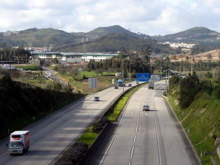
Autoestrada is the Portuguese language word for "motorway" or "freeway." Portugal has about 3,000 km of motorways, crossing all the coast and connecting the main inland cities and towns. Several autoestradas are linked with the Spanish motorway system and, through Spain, to the rest of Europe.
During the 1990s and early 2000s, Portugal was the country with the greatest development in the motorway network in the European Union. It had 316 km of motorways in 1990 and the number increased to 1242 km by 1999 and 2100 km by the end of 2007.
Although administratively, a separate motorway network exists, in practice each autoestrada overlaps part or all of an IP (Itinerário Principal or Main Itinerary) or an IC (Itinerário Complementar or Complementary Itinerary). These are designated with an "A" code as well as an IP or an IC code, though they are typically only signalized by the A designation. In addition, many of these roads are part of the European road network, and so also carry an "E" designation, which may serve as reference for non-Portuguese drivers.
Label:
Tolls and taxation
Toll payment in Portugal uses a pioneer electronic payment system, Via Verde. The driver installs a small device on the front windshield that communicates electronically with Brisa (the company responsible for managing most of the motorways in Portugal). Since the payment is done electronically, it is quick to enter or leave the motorway, avoiding payment lines (which are still available (mostly) for drivers who haven't adhered to Via Verde).
This system has won several prizes for its innovative form of paying for services.
Itinerários principais
There are 9 itinerários principais (principal routes), signalized by the prefix IP, designated IP1 through IP9.
IP1 and IP2 forms cross national, North-South routes, the first running by the west part of the country, but ending in the southeast border of Castro Marim/Vila Real de Santo António and the second one by the east part, roughly close to the border with Spain.
All other routes follow a West-East route, with the exception of IP3, that runs mostly North-South.
All itinerários principais, except IP6 and IP9, are connected with the Spanish border. IP2 reaches Spain by route of N103-7, in the region of Trás-os-Montes e Alto Douro.
Itinerários complementares
There are 37 itinerários complementares (complementary routes), signalized by the letters IC, designated IC1 through IC37.
Note: Italics and -**- refers to unbuilt sections.
Estradas nacionais
Estradas nacionais (national routes) are the 1945 Plan's roads that were kept in the Complementary Network, usually as branches of IPs or ICs, to connect these to local destinations. In the 1985 Plan, these were generically referred as "other roads". They kept the same numbering they had in the 1945 Plan, with the prefix N, and they are administered by the agency Estradas de Portugal.
Most of the estradas nacionais are now roads of low importance (even those that were principal roads in the 1945 Plan), because over the last decades were passed over by the motorways, IP and IC routes.
Many of the 1945 Plan's estradas nacionais were transferred to the municipal authorities administration and are now not part of the National Roadway Network. However, most of these roads had its designation not changed, keeping its old numbering and the N prefix.
Estradas regionais
Estradas regionais (regional roads) integrate the Regional Network. These road class was created in 1998, with the approval of 2000 National Roadway Plan. According Law n.º 222/98 "the public road communications with supra-municipal interest, and complementary to the National Road Network, are carried by Regional Roads".
Each regional road maintains the number of the national road or municipal road that originated it. Regional roads are represented by the letter R. Because, in 1998, it was rejected in a referendum, a reform which consisted of the creation of eight administrative regions in mainland Portugal, nowadays, some regional roads are administrated by Estradas de Portugal, while others are administrated by Portuguese municipalities.
Estradas municipais
Estradas municipais (municipal roads) are represented by the letter M, and they are administrated by Portuguese municipalities. These routes were created in 1961, and, over the years, many branches of national routes had been municipalized. Some municipal routes created by the 1985 Plan, were renamed as "national roads" or "regional roads" in the 2000 Plan.
Euro Routes
Portugal is crossed by some European Routes: