
Country United States Founded 1852 Area code 718, 347, 646 Elevation 50 m Borough The Bronx | State New York ZIP codes 10463, 10471 Area 7.029 km² Population 48,049 (2010) | |
 | ||
Named for The numerous brooks, streams and meadows in the hilly region. Restaurants Riverdale City Grill, Palace of Japan, Moss Café, Aoyu Sushi, Hunan Balcony | ||
muninyc west 242nd street broadway riverdale bronx 10471
Riverdale is an upper middle class residential neighborhood in the northwest portion of the Bronx, a borough in New York City. Riverdale, which has a population of 47,850 as of the 2000 United States Census, contains the northernmost point in New York City.
Contents
- muninyc west 242nd street broadway riverdale bronx 10471
- Map of Riverdale Bronx NY USA
- History
- Geography
- Media
- Demographics
- Housing
- Education
- Fire department
- Transportation
- Parks
- Community organizations
- Museums
- In popular culture
- References
Map of Riverdale, Bronx, NY, USA
History
In 1642, Anthony Van Corlaer died while attempting to swim across the Hudson from nearby Spuyten Duyvil. A witness to Van Corlaer's death stated that "the devil" in the shape of a giant fish swam up and proceeded to "seize the sturdy Anthony by the leg and drag him beneath the waves." This may be the earliest recorded shark attack in the New World. In the late 17th century, Frederick Philipse, the lord of Philipse Manor in Westchester County, received permission to construct a bridge across Spuyten Duyvil Creek and charge tolls. "King's Bridge", which was located roughly south of and parallel to where West 230th Street lies today, opened in 1693.
Early in its residential development, Riverdale was a 19th-century estate district where many of Manhattan's moguls built their country estates; for example, in northern Riverdale, what is now Fieldston was part of the estate of Major Joseph Delafield, who purchased 250 acres (100 ha) in 1829, and named it after his family's estate in England. At the turn of the century, the new popularity of railroad commute enabled wealthy businessmen to make Riverdale their year-round residence. Fieldston, owned by a private association, is a particularly intact example of a turn-of-the century upper class suburb. The Hudson Hill neighborhood retains many of its historic mansions. Riverdale's elite private schools and historic churches also reflect this past. Development of the neighborhood began in the latter half of the 19th century once the New York Central and Hudson River Railroad came through. The tracks originally crossed Spuyten Duyvil Creek and into Manhattan on the west side, but Cornelius Vanderbilt wanted to consolidate his railroad operations into one terminal, so he had tracks laid along the north side of the Harlem River so that trains coming south from Albany could join with the Harlem and New Haven lines and come into Manhattan down Fourth Avenue into his new Grand Central Depot. This is the route still used by Metro-North today.
The Delafield family laid out lots in Fieldston in 1909 – the year after the IRT Broadway – Seventh Avenue Line was extended to Van Cortlandt Park–242nd Street, intending to develop the land, which at first was called "Delafield Woods". Rather than use a grid plan, civil engineer Albert E. Wheeler, following the suggestions made by Frederick Law Olmsted and James R. Croes in 1876, designed a street plan which followed the contours of the land and preserved as much of the wooded areas as possible. The first house was begun in 1910 and finished in 1911; by the beginning of the 21st century, Fieldston, a gated community, was one of the wealthiest neighborhoods in New York City. Leland Weintraub, the commissioner who moved for the district's creation, noted that "most of the features commonly associated with the American romantic suburb of the mid-19th century", including "a picturesque site, landscaping and architecture; connection to the city by accessible transportation and a layout adapted to the topography" are present in the area.
As the 20th century progressed, upscale apartment buildings and smaller houses were added to the neighborhood. To this day, Riverdale continues to maintain its character as an affluent enclave in the city of New York. The rich history of Riverdale has led to the creation of the Riverdale Historic District.
In May 2009, the FBI ran a sting operation to prevent a bombing plot in which two Riverdale synagogues were the suggested targets. This followed a Molotov cocktail attack in 2000 on a different Riverdale synagogue and the 1989 firebombing of the Riverdale Press.
On July 26, 2010, the National Weather Service confirmed that an EF1 tornado had hit Riverdale the day before. There were no fatalities, but seven people were injured.
On December 1, 2013, a train derailment near Spuyten Duyvil station resulted in four deaths and over 70 injuries, of which 11 were critical.
Geography
Riverdale covers about three square miles in area. It has one of the highest elevations in New York City, affording it views of the Empire State Building, George Washington Bridge, Hudson River and New Jersey Palisades. It is also noted for the numerous parks and expanses of greenery and original forest that complement its hilly landscape. The neighborhood is bordered on the north by the city of Yonkers in Westchester County, and on the west by the Hudson River, but its eastern and southern boundaries are frequently disputed. The AIA Guide to New York City gives Broadway as the eastern boundary, and the Harlem River as the southern. There are several long-debated subsections of Riverdale:
(Riverdale East of Fieldston Road and above West 254th Street, includes Spencer Ave, Huxley Rd, Post Rd, and Broadway)
The leafy, scenic enclave of Fieldston was designated a historic district by the New York City Landmarks Preservation Commission in 2006. There is also a 15-acre Riverdale Historic District in the northwest of the neighborhood, designated in 1990.
Riverdale's ZIP codes are 10463 and 10471. While 10471 is entirely in Riverdale, 10463 also covers the adjacent neighborhoods of Kingsbridge and Marble Hill.
Administratively, Riverdale is part of Bronx Community Board 8.
Media
Two weekly newspapers, the Riverdale Press and the Riverdale Review, focus on news of interest to residents of the neighborhood.
Demographics
As of the 2000 census, there were 47,850 people residing in Riverdale. The population density was 19,997 per square mile (7,724/km²). The racial makeup of the neighborhood was 78.74% White (71.89% White Non-Hispanic), 5.36% Asian, 0.05% Pacific Islander, 7.66% Black, 0.16% Native American, 4.85% from other races, and 3.18% from two or more races. Of those, 13.38% of the population were Hispanic of any race. Fully 24.15% of the population was foreign born; of this, 51.76% came from Europe, 22.92% from Latin America, 21.71% from Asia and 3.61% from other parts of the world. Riverdale is well known for its substantial Jewish, Irish and Russian-speaking populations.
With a median residence value of $579,196, Riverdale is one of the most expensive neighborhoods in New York City and is considered one of the most sought-after residential neighborhoods. Riverdale is known for having some of the lowest crime rates in New York City.
Housing
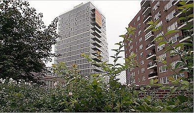
Riverdale is home to the modernist landmark Saul Victor house, designed by Ferdinand Gottlieb in 1967. Other famous mansions in the Hudson Hill neighborhood include: Greyston (1864), Alderbrook (1880), Stonehurst (1861) and Oaklawn (1863) Since 2005, Central Riverdale has experienced a building boom with the addition of many mid- and high-rise condominium buildings.
Before the wider development of Riverdale, housing consisted of large, architecturally distinguished mansions built in the early 20th century, mostly in Georgian- and Tudor-revival styles, which recall scenes of "rural Connecticut" rather than the city. These are mostly concentrated in the Fieldston section of Riverdale, known as the estate area. In addition, more affordable pre-war buildings and smaller houses are scattered throughout Riverdale. The 1950s saw the construction of many low-rise (six-story) brick buildings. By the early to mid-1960s, a number of larger brick towers (10–20 stories) started popping up. Many of these full-service buildings featuring doormen were designed by architect Philip Birnbaum, who designed over 300 buildings in the city, including Skyview, the Windsors, and the Whitehall.
In 1974, a large, fortress-like residential compound and school was established in North Riverdale by the Permanent Mission of the USSR to the United Nations (now the Permanent Mission of the Russian Federation to the UN) to house diplomats and their families. The 20-story building was constructed from the top down, with the upper floors built first.
By the 1980s, most of the apartment buildings that were owned by single landlords and rented, were converted into cooperatives. Unlike most of the Bronx, Riverdale is mostly owner-occupied housing. Spuyten Duyvil has the greatest concentration of high rises in Riverdale with the Century, 555 Kappock, and Winston Churchill next to one another. Since 2005, Central Riverdale has experienced a building boom with the addition of many mid- and high-rise condominium buildings that contrast with the older brick style.
In August 2008, Columbia University purchased an almost-completed apartment building near Henry Hudson Parkway for use as faculty housing.
Education
The public schools are a part of the New York City Department of Education. The public elementary schools are the Spuyten Duyvil School (P.S. 24) and the Robert J. Christen School (P.S. 81). The public middle school and high school is M.S./H.S 141, the Riverdale Kingsbridge Academy. Nearby public high schools that serve the community include the Bronx High School of Science, John F. Kennedy High School and InTech Academy, which is also a middle school.
Riverdale is home to three top-tier private schools: Horace Mann, Riverdale Country, and Fieldston, all members of the Ivy Preparatory School League; and two Roman Catholic colleges: The College of Mount Saint Vincent and Manhattan College.
An increase in the Jewish population of the neighborhood in the late twentieth century led to Riverdale now being home to top-ranked Jewish day schools, the SAR Academy, an elementary school, and the SAR High School, as well as the Yeshiva of Telshe Alumni and Yeshivat Ohavei Torah Rabbinical School. Catholic elementary schools in the area are Visitation School, St. Gabriel's School and St. Margaret of Cortona School, where President John F. Kennedy received his First Communion.
The area also has several preschools. Kinneret Day School is a private Jewish day school in Spuyten Duyvil, serving grades K through 8 in addition to pre-school. Others are BedRock Preschool, the Riverdale Temple Nursery School, Spuyten Duyvil Preschool, SAR Academy (Early Learning Center), Riverdale Nursery School and Family Center, the Riverdale Presbyterian Church Nursery School, and Riverdale Montessori School.
The Russian Mission School in New York is located in Riverdale, on the grounds of the Russian Mission Residency.
Fire department
Riverdale's local FDNY Fire Station is Engine 52/Ladder 52, located at 4550 Henry Hudson Parkway East in Central Riverdale. Engine 52/Ladder 52 is the only firehouse in Riverdale and the northernmost fire station operated by the FDNY. (Engine and Ladder 52 and Engine and Ladder 10 on Liberty Street in Lower Manhattan are the only two FDNY fire companies where the engine company and the ladder company have the same number.) Engine Company 52 currently operates a 2003 Seagrave Commander II Custom 1000/500 Pumper Engine and Ladder Company 52 currently operates a 2006 Seagrave Commander II Custom 100' Rear-Mount Aerial Ladder Truck.
Transportation
The Van Cortlandt Park – 242nd Street subway station of the IRT Broadway – Seventh Avenue Line (1 train) of the New York City Subway is located at the intersection of 242nd Street and Broadway, along with the 238th Street, and 231st Street stations provides subway service to and from Manhattan. Riverdale is also accessible from Kingsbridge, Inwood, and Washington Heights by the Bx3, Bx7, Bx9, Bx10, Bx20 bus lines that run throughout the Riverdale area. Metro-North commuter railroad service is available at two stations, both on the Hudson Line: the Spuyten Duyvil station, located underneath the Henry Hudson Parkway and alongside the shore of the Harlem River at Edsall Avenue; and at the Riverdale station, located between West 254th Street and West 255th Street.
By car, Riverdale is commonly reached by the Henry Hudson Parkway (NY 9A) via the Henry Hudson Bridge, and by Broadway (US 9) via the Broadway Bridge.
Bus service to Riverdale includes the New York City's MTA Regional Bus Bx1, Bx3, Bx7, Bx9, Bx10, Bx20, BxM1, BxM2, BxM3, BxM18 routes, as well as the Bee-Line Bus System routes 1, 2, 3, and 8.
Parks
Wave Hill, a combination botanical garden and outdoor art gallery, is located in the so-called Hudson Hill overlooking the Hudson River.
Gaelic Park, the headquarters of the New York GAA, is where Gaelic football and hurling are played in the New York metropolitan area. It is located at West 240th Street.
Bell Tower Park next to the Henry Hudson Parkway has the Riverdale Monument, a stone war memorial built in 1930.
Community organizations
Museums
In popular culture
Riverdale has often been cited in literature, film and television. Exteriors of many of Riverdale's locations have been used in both television and movie production.
Literature
Films
Television