
County Stanislaus Time zone Pacific (PST) (UTC-8) Elevation 43 m Zip code 95367 Population 23,504 (2013) | Incorporated August 23, 1922 FIPS code 06-61068 Area 10.66 km² Local time Sunday 4:55 PM Area code 209 | |
 | ||
Weather 23°C, Wind NW at 5 km/h, 47% Humidity | ||
Riverbank is a city in Stanislaus County, California, United States. The population was 22,678 at the 2010 census, up from 15,826 at the 2000 census. Incorporated on August 23, 1922, Riverbank's official slogan is "The City of Action." It is part of the Modesto Metropolitan Statistical Area.
Contents
- Map of Riverbank CA USA
- History
- Downtown revitalization
- Geography
- 2010
- 2000
- Government
- Transportation
- Events
- Public safety
- Schools
- Climate
- Notable people
- References
Map of Riverbank, CA, USA
Riverbank was founded as a ferry crossing, and was established as a town with the coming of the Santa Fe Railroad.
The town holds a Cheese & Wine Exposition each October.
History
In the 1850s, the Riverbank area was known as Burneyville. Major James Burney, sheriff of Mariposa, established the Burneyville Ferry over the Stanislaus River at the site of the modern bridge in Riverbank.
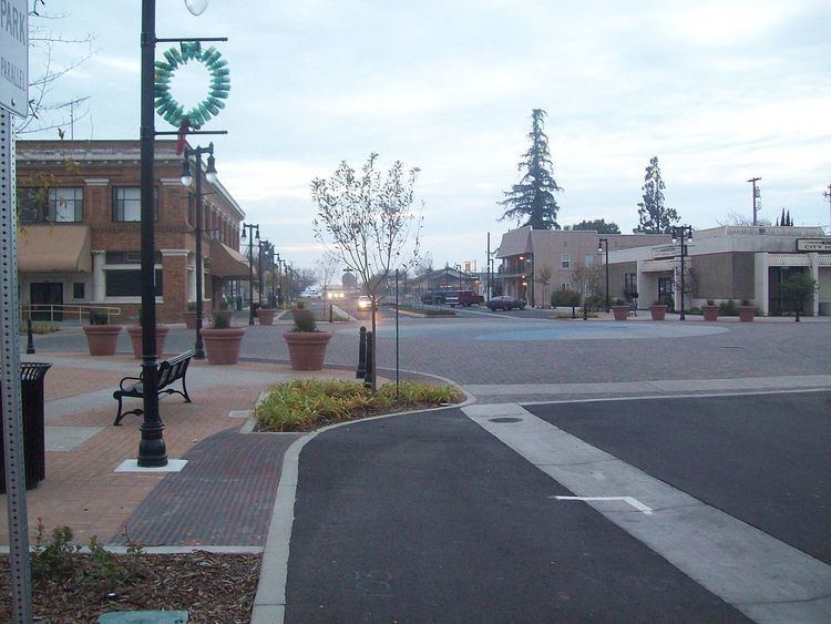
Downtown revitalization
Riverbank's downtown was remodeled in 2009. New attractions include a downtown plaza with a mural and statue of a cable ferry operator.
The Riverbank Branch Library on Santa Fe Street is listed on the National Register of Historic Places.
Geography
According to the United States Census Bureau, the city has a total area of 4.1 square miles (11 km2), of which, 4.1 square miles (11 km2) of it is land and 0.02 square miles (0.052 km2) of it (0.59%) is water.
2010
The 2010 United States Census reported that Riverbank had a population of 22,678. The population density was 5,509.4 people per square mile (2,127.2/km²). The racial makeup of Riverbank was 14,951 (65.9%) White, 480 (2.1%) African American, 269 (1.2%) Native American, 770 (3.4%) Asian, 88 (0.4%) Pacific Islander, 4,949 (21.8%) from other races, and 1,171 (5.2%) from two or more races. Hispanic or Latino of any race were 11,822 persons (52.1%).
The Census reported that 22,510 people (99.3% of the population) lived in households, 96 (0.4%) lived in non-institutionalized group quarters, and 72 (0.3%) were institutionalized.
There were 6,579 households, out of which 3,380 (51.4%) had children under the age of 18 living in them, 4,053 (61.6%) were opposite-sex married couples living together, 880 (13.4%) had a female householder with no husband present, 434 (6.6%) had a male householder with no wife present. There were 413 (6.3%) unmarried opposite-sex partnerships, and 42 (0.6%) same-sex married couples or partnerships. 923 households (14.0%) were made up of individuals and 358 (5.4%) had someone living alone who was 65 years of age or older. The average household size was 3.42. There were 5,367 families (81.6% of all households); the average family size was 3.76.
The population was spread out with 7,044 people (31.1%) under the age of 18, 2,217 people (9.8%) aged 18 to 24, 6,633 people (29.2%) aged 25 to 44, 4,891 people (21.6%) aged 45 to 64, and 1,893 people (8.3%) who were 65 years of age or older. The median age was 31.0 years. For every 100 females there were 99.3 males. For every 100 females age 18 and over, there were 96.6 males.
There were 7,069 housing units at an average density of 1,717.3 per square mile (663.1/km²), of which 4,753 (72.2%) were owner-occupied, and 1,826 (27.8%) were occupied by renters. The homeowner vacancy rate was 2.8%; the rental vacancy rate was 7.0%. 15,965 people (70.4% of the population) lived in owner-occupied housing units and 6,545 people (28.9%) lived in rental housing units.
2000
As of the census of 2000, there were 15,826 people, 4,544 households, and 3,821 families residing in the city. The population density was 5,091.7 people per square mile (1,964.8/km²). There were 4,698 housing units at an average density of 1,511.5 per square mile (583.3/km²). The racial makeup of the city was 66.85% White, 1.53% African American, 1.43% Native American, 1.31% Asian, 0.13% Pacific Islander, 24.03% from other races, and 4.72% from two or more races. Hispanic or Latino of any race were 45.91% of the population.
There were 4,544 households out of which 49.6% had children under the age of 18 living with them, 65.0% were married couples living together, 13.2% had a female householder with no husband present, and 15.9% were non-families. 11.9% of all households were made up of individuals and 4.2% had someone living alone who was 65 years of age or older. The average household size was 3.45 and the average family size was 3.73.
In the city, the population was spread out with 33.9% under the age of 18, 9.9% from 18 to 24, 30.8% from 25 to 44, 18.2% from 45 to 64, and 7.2% who were 65 years of age or older. The median age was 30 years. For every 100 females there were 97.4 males. For every 100 females age 18 and over, there were 95.1 males.
The median income for a household in the city was $44,668, and the median income for a family was $47,411. Males had a median income of $36,370 versus $29,012 for females. The per capita income for the city was $14,972. About 9.3% of families and 12.3% of the population were below the poverty line, including 14.8% of those under age 18 and 4.9% of those age 65 or over.
The California State Department of Finance estimates the population of Riverbank as of January 1, 2006 to be 21,215 people, an estimated 34.1% increase since 2000.
Government
In the California State Legislature, Riverbank is in the 5th Senate District, represented by Democrat Cathleen Galgiani, and the 12th Assembly District, represented by Republican Heath Flora.
In the United States House of Representatives, Riverbank is in California's 10th congressional district, represented by Republican Jeff Denham.
Transportation
The BNSF Railway has a mainline running through Riverbank and serves as the BNSF's principal line linking Northern California with the Los Angeles-Chicago mainline. The line used to be owned by the Santa Fe Railway (ATSF).
Amtrak had a station in Riverbank which also served nearby Modesto, California; it was closed on November 1, 1999, and burned to the ground accidentally in 2005.
Stanislaus Regional Transit (StaRT) provides fixed route and dial-a-ride service throughout the county, which enables Riverbank residents to travel to other areas of the county and to Modesto, which is served by Amtrak's San Joaquin passenger train. Greyhound bus service is also available in Modesto.
Events
Each year during the second weekend of October, the annual Cheese & Wine Exposition is held. The two-day event features wine and cheese tasting, carnival games, and arts and crafts booths. The Expo draws thousands of people from surrounding towns and agricultural areas.
Public safety
The Stanislaus County Sheriff's Department provides police services to the city.
Schools
Elementary schools
Middle schools
High schools
Other schools
Climate
Winter temperatures range from the mid 40s to the high 60s, summer temperatures from the 50s to the 100s.