The River Tyne is a river in Scotland. It rises in the Moorfoot Hills in Midlothian near Tynehead to the south of Edinburgh, at the junction of the B6458 and the B6367. It continues for approx. 30 miles in a north-eastern direction, and it empties into the North Sea near Belhaven.
The Tyne is mainly a confluence between the Birns Water and the Tyne Water, approx. 2 km east of Easter Pencaitland and 1 km south west of Spilmersford Bridge, in the grounds of Saltoun Hall. The Humbie Water is another main headwater.
The Tyne has a number of tributaries:
Bellyford Burn, rises east of Dalkeith; passes north of Cousland, Midlothian and south of Carberry Hill; south of Elphinstone Tower; north of Ormiston; joins Puddle Burn; joins Tyne Water at Winton House.
Kinchie Burn, rises east of Pathhead; supplies Glenkinchie Distillery; joins Birns Water at Milton Bridge, West Saltoun.
Blackford Burn/Belsis Burn/Murray's Burn, joins the Tyne Water at Pencaitland.
Cock Burn, rises at Lower Saltoun, joins the Tyne at Badger Wood.
Fala Dam Burn, East Water, Salters' Burn and Blackhouse Burn combine into Keith Water which flows into Humbie Water, south of Humbie Kirk.
Johnstounburn Water rises near Woodcote Mill and joins Humbie Water near Saltoun Forest.
Letham Burn and St Laurence House Burn combine to join the Tyne at the southern outskirts of Haddington.
Bearford Burn rises in Playmuir wood and joins the Tyne at Beanston Mill.
Old Hailes Burn joins the Tyne at Hailes Castle.
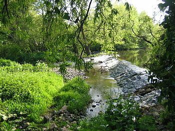
Gallery starts with the Tyne's main headwaters: Birns Water, Tyne Water, Humbie Water
On its way to the North Sea, the Tyne passes through, or near to, the following places:
Easter Pencaitland; Spilmersford Bridge, B6355 road; Saltoun Hall
Nisbet; Badger Wood; Herdmanston Mains
Samuelston bridge; Begbie; Grants' Braes Bridge on B6368
Clerkington and Clerkington Mill
Haddington: Knox Academy; Stevenson Bridge; Cheviot House Mill; Sports Centre; Waterloo Bridge B6368; St. Mary's Church; Nungate Bridge; Victoria Bridge
Abbey Bridge, Abbeymill Farm (south of the A1); Lady's Wood; Stevenson House
Sandy's Mill; Beanston Mill; Brown Knowe Plantation;
Hailes Castle, Hailes Mill
A1 Bridge, Brae Heads, north of Traprain Law
East Linton; A199 bridge; B1377 bridge
Phantassie Farm, birthplace of John Rennie (engineer); Phantassie Doocot
alongside the B1407, past Prestonkirk Parish Church and Preston Mill
Knowes Mill; Acre Plantation; Tyninghame Bridge, A198; Firth Plantation
Tyninghame House north of the Tyne
Mosshouse Point; Hedderwick Sands; Belhaven Bay, Tyne Sands, St. Baldred's Cradle, John Muir Country Park
The River Tyne's journey from Spilmersford Bridge to the Tyne Estuary
Survey of Water Voles within the Tyne catchment, by Scottish Natural Heritage
East Lothian Courier article 24/01/08, Otter revival on the Tyne
Threespine sticklebacks in the River Tyne / Edinburgh Univ. Institute of Evolutionary Biology
Scottish Environment Protection Agency report: "Scotland's Water Environment Review 2000-2006"
Fishing tips for River Tyne
The East Lothian Angling Association controls 25 miles of the tyne and its feeder burns; there are Brown trout and sea trout.