
Length 15 km Country United Kingdom | ||
 | ||
River mouth River Wharfe194 m (636 ft) | ||
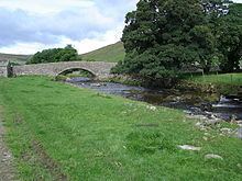
River Skirfare is a small river in North Yorkshire, England, that flows through Littondale and ends where it joins the larger River Wharfe. The source is the confluence of Foxup Beck and Cosh Beck at the hamlet of Foxup.
Contents
- Map of River Skirfare United Kingdom
- Course
- Natural history
- Economy
- Tributaries
- Settlements
- Crossings
- References
Map of River Skirfare, United Kingdom
Course
The source of the river is the confluence of Foxup Beck and Cosh Beck at the hamlet of Foxup. To the east bank lays Hawkswick Moor and on the west bank lays Darnbrook Fell, Hawkswick Clowder and Pen-y-ghent Fell. The river meanders consistently south-east for approximately 9.47 miles (15.24 km) to the confluence with the River Wharfe.
Natural history
The flora and fauna found along the river are similar to that found along the nearby River Wharfe.
Economy
The economy of the area around the river are similar to that found along the nearby River Wharfe.
Tributaries
From the source of the river:
Settlements
From the source of the river:
Crossings
From the source of the river: