
- elevation 360 m (1,181 ft) - elevation 6 m (20 ft) Discharge 8.7 m³/s Country United Kingdom | - average 8.70 m/s (307 cu ft/s) | |
 | ||
- max 188.0 m/s (6,639 cu ft/s) 9 January 1968 | ||
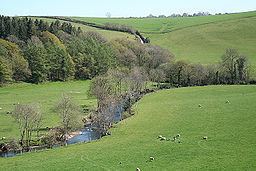
The River Mole a tributary of the River Taw in Devon which rises on the southwestern border of Exmoor. The river takes its name from the market towns of North and South Molton. The river used to be known as the Nymet.
Contents
Map of River Mole, United Kingdom
TributariesEdit
References
River Mole, Devon Wikipedia(Text) CC BY-SA