
- left Day Brook Basin area 124 km² | - average 0.67 m/s (24 cu ft/s) | |
 | ||
- location | ||
The River Leen is 15 mile (24km) long tributary of the River Trent that flows through Nottinghamshire, and the city of Nottingham in the East Midlands of England.
Contents
Map of River Leen, United Kingdom
CourseEdit
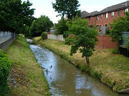
The Leen rises as a series of springs at the foot of the Robin Hood Hills just outside Annesley. It then flows through the grounds and lakes of Newstead Abbey, passing Papplewick and on through Bestwood Country Park, following the route of the Leen Valley into suburban and urban Nottingham. Within the city it flows through the centre of Bulwell, and passes Basford where it is joined by the Day Brook. The Leen then flows through Radford, and Lenton before joining the River Trent next to Riverside Way in The Meadows.
HistoryEdit
Leen is a corruption through various renderings of the Celtic word llyn, "lake" or "pool", and Anglo‐Saxon hlynna, meaning "streamlet". Some of the surrounding villages derived their name from the River Leen. Lenton, ton being the Saxon word for "village"; and Linby, by being the Danish equivalent of ton.
From Lenton onwards the course of the Leen has been quite radically altered on a number of occasions, notably culverted by the Borough Engineer, Marriott Ogle Tarbotton, but the river's present course is believed to follow much the same route as it did originally. Originally it discharged into the Beeston Canal, flowed some distance along the canal and thence over a small weir into the Tinker’s Leen (where the modern Courts complex is now situated) and so into the Trent just downstream of Trent Bridge.
Recent developmentsEdit
Nottingham City Council planning guidance and best practice from the Environment Agency is now to remove culverts, which are expensive to maintain and can cause flooding when they are blocked or damaged. As a result, a number of developments along the course of the Leen now open up previously culverted stetches of the waterway.
A new Tesco development in Bulwell town centre, which received planning permission in 2008, will remove the culvert under the former Kwik Save supermarket.
In Radford, a new student village at Chettle's Yard will open up a long stretch of the river parallel to the railway line.
And the eastern part of the University of Nottingham's Jubilee Campus opens up a section of the river's urban route through Lenton, a small lake having been created to the rear of the Sir Colin Campbell building, adjacent to the concrete channel (through which the Leen still flows) that was originally built to prevent the flooding of the now-demolished Raleigh cycle factory. The river then passes through several industrial units and under Triumph Road, before re-appearing behind the Nottingham Emergency Medical Services centre (the old AA building) on Derby Road. The Leen is sometimes mistakenly believed to pass through the main part of the Jubilee Campus, but the lake and other water features in that area are artificial in nature.